File:Navit-ffm.png

Original file (955 × 732 pixels, file size: 169 KB, MIME type: image/png)
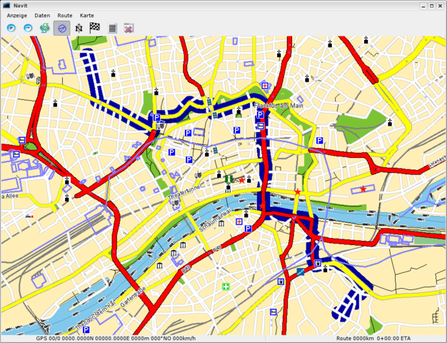
Navit (version from CVS; 2008-01-04) showing OSM data from Frankfurt/Main, Germany and a calculated route between two specified points
Navit is a great open-source (GPL) application for routing and navigation. It contains a utility to convert .osm-files to the binary file format used by the main application. There is a SDL and a GTK+ interface. The route calculation is rather fast and it will even guide you with speech-output using speechd or espeak. Since navit renders the map on-the-fly, there's no need for storing a large number of picture-files on the hard drive or even having an internet-connection while using it. Map data from GeoFabrik's Europe-extract from Dec, 30th 2007 is only 151MB in the binary file format. (The .osm.bz2 used to build the binary data was 320MB)
The image shows navit displaying a part of Frankfurt_am_Main using the GTK+ interface with a route calculated by navit.

Front-page image on 19 Jan 2008
File history
Click on a date/time to view the file as it appeared at that time.
| Date/Time | Thumbnail | Dimensions | User | Comment | |
|---|---|---|---|---|---|
| current | 15:21, 4 January 2008 | | 955 × 732 (169 KB) | Jannis (talk | contribs) | Navit (version from CVS; 2008-01-04) showing OSM data from Frankfurt/Main, Germany and a calculated route between two specified points |
You cannot overwrite this file.
File usage
The following 3 pages use this file: