File:NearMap Coverage Adelaide, Fleurieu Peninsula and Murray Region February 2 2010.png
Jump to navigation
Jump to search

No higher resolution available.
NearMap_Coverage_Adelaide,_Fleurieu_Peninsula_and_Murray_Region_February_2_2010.png (250 × 300 pixels, file size: 40 KB, MIME type: image/png)
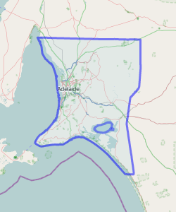
Adelaide/Fleurieu Peninsula/Murray Region NearMap coverage as of February 2, 2010
Licensing
![]()
![]()
![]()
This screenshot contains OpenStreetMap Carto rendering.
The OpenStreetMap Carto map style is made available under the Creative Commons CC-0 1.0 Universal Public Domain Dedication.
- Attribution to the map data:
![]()
Contains map data © OpenStreetMap contributors, made available under the terms of the Creative Commons Attribution-ShareAlike 2.0 (CC-BY-SA-2.0).
File history
Click on a date/time to view the file as it appeared at that time.
| Date/Time | Thumbnail | Dimensions | User | Comment | |
|---|---|---|---|---|---|
| current | 05:41, 7 April 2011 | | 250 × 300 (40 KB) | Lakeyboy (talk | contribs) | |
| 06:21, 2 February 2010 | 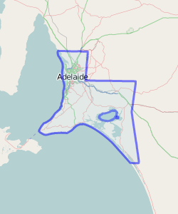 | 250 × 300 (21 KB) | Lakeyboy (talk | contribs) | Adelaide/Fleurieu Peninsula/Murray Region NearMap coverage as of February 2, 2010 |
You cannot overwrite this file.
File usage
The following page uses this file: