File:OCHA versus prior import boundary discrepancy.png
Jump to navigation
Jump to search

No higher resolution available.
OCHA_versus_prior_import_boundary_discrepancy.png (510 × 438 pixels, file size: 26 KB, MIME type: image/png)
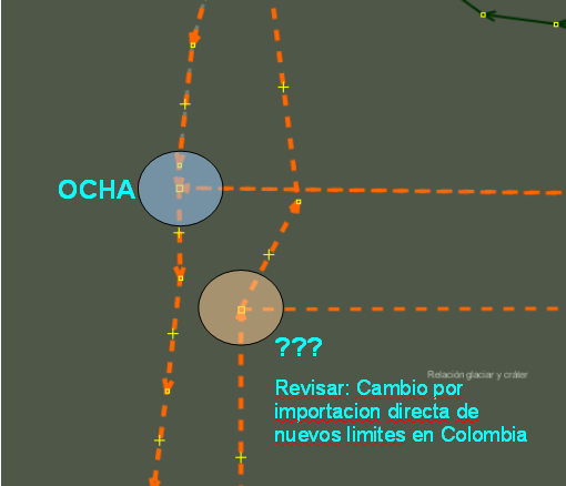
This image is centered around 4.887N-75.318W showing two boundary sets for the same municipalities in Colombia.
Licensing
![]()
The creator of this work, ceyockey, has released it into the public domain. This applies worldwide.
In case this is not legally possible, the creator has granted anyone the right to use this work for any purpose, without any conditions, unless such conditions are required by law.
Notice to creator or uploader: CC0 license might be more suitable. "Releasing work to public domain" has some issues, as it is not well defined in some jurisdictions and/or it is not actually possible to "release to public domain". Using CC0 license achieves the intended effect while avoiding such problems and is well suited for media files.
File history
Click on a date/time to view the file as it appeared at that time.
| Date/Time | Thumbnail | Dimensions | User | Comment | |
|---|---|---|---|---|---|
| current | 10:19, 30 December 2010 | | 510 × 438 (26 KB) | Ceyockey (talk | contribs) | croppped version of prior upload, removing whitespace |
| 10:18, 30 December 2010 |  | 816 × 1,056 (53 KB) | Ceyockey (talk | contribs) | This image is centered around 4.887N-75.318W showing two boundary sets for the same municipalities in Colombia. {{PD-creator|ceyockey}} Category:Images of JOSM |
You cannot overwrite this file.
File usage
The following page uses this file: