File:OSM-Routing-Data-Layer.svg.png
Jump to navigation
Jump to search

Size of this preview: 738 × 599 pixels. Other resolutions: 296 × 240 pixels | 591 × 480 pixels | 793 × 644 pixels.
Original file (793 × 644 pixels, file size: 125 KB, MIME type: image/png)
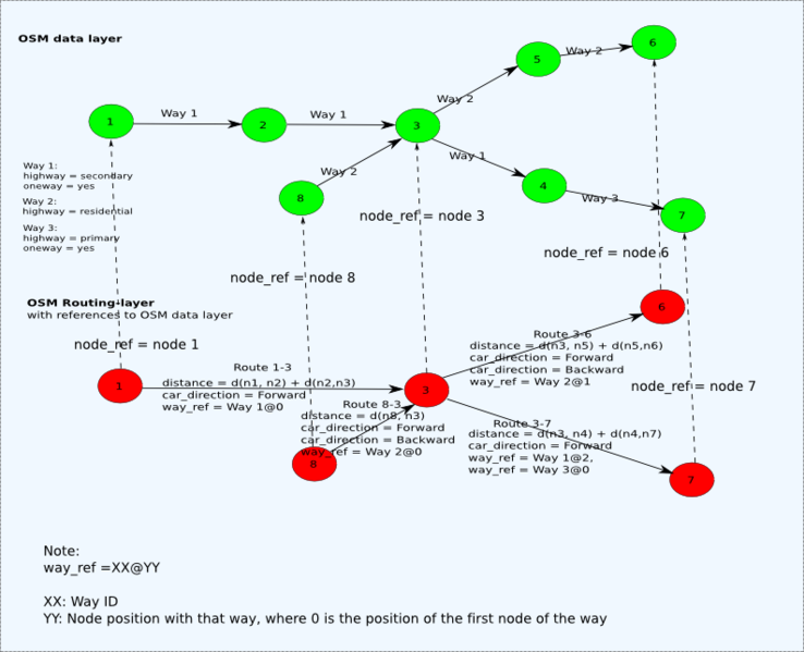
Show how OSM data could become transformed to routing data with referencing of the routing nodes
File history
Click on a date/time to view the file as it appeared at that time.
| Date/Time | Thumbnail | Dimensions | User | Comment | |
|---|---|---|---|---|---|
| current | 22:09, 5 April 2008 | | 793 × 644 (125 KB) | Josy (talk | contribs) | |
| 22:00, 5 April 2008 |  | 6,344 × 5,149 (1.37 MB) | Josy (talk | contribs) | ||
| 07:27, 28 March 2008 |  | 396 × 322 (46 KB) | Josy (talk | contribs) | Show how OSM data could become transformed to routing data with referencing of the routing nodes |
You cannot overwrite this file.
File usage
The following page uses this file: