File:OSM-gps-point-by-country-cartogram.png
Original file (2,931 × 1,747 pixels, file size: 124 KB, MIME type: image/png)
Summary
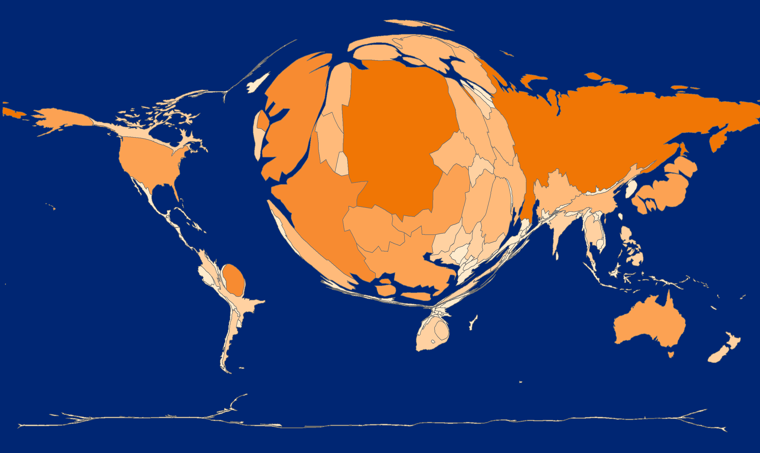
Cartogram derived from the April 2012 GPS point dataset.
Countries are sized in proportion to the number of GPS points falling within their borders.
This is a first draft. Caveats :-
- this was done using a spatial join on a low resolution grid (1 degree square), so smaller countries may appear smaller or larger than they should
- the sample size was quite small (1%), although this still represents 28 million points ;-)
- it only counts those points falling on land, and doesn't include off-shore points inside of maritime boundaries
Licensing
![]()
![]()
![]()
Attribution not specified as a parameter! THIS LICENSE ALWAYS REQUIRES ATTRIBUTION! Use {{CC-BY-SA-2.0|Attribution, typically name of author}} See Template:CC-BY-SA-2.0 for full description how this template should be used.
Note, there is
{{CC-BY-SA-2.0 OpenStreetMap}} for files based on old OSM map data, before the license change made on 2012-09-12.There is also
{{OSM Carto screenshot||old_license}} for files based on old OSM map data, before the license change made on 2012-09-12, created using OSM Carto map style.
File history
Click on a date/time to view the file as it appeared at that time.
| Date/Time | Thumbnail | Dimensions | User | Comment | |
|---|---|---|---|---|---|
| current | 18:37, 19 August 2012 | | 2,931 × 1,747 (124 KB) | Stevefaeembra (talk | contribs) | Cartogram derived from the April 2012 GPS point dataset. Countries are sized in proportion to the number of GPS points falling within their borders. This is a first draft. Caveats :- - this was done using a spatial join on a low resolution grid (1 degr |
You cannot overwrite this file.
File usage
The following page uses this file: