File:OSM-map-Bing-14.7498-75.0837-b.jpg
Jump to navigation
Jump to search


Size of this preview: 617 × 599 pixels. Other resolutions: 247 × 240 pixels | 494 × 480 pixels | 880 × 855 pixels.
Original file (880 × 855 pixels, file size: 240 KB, MIME type: image/jpeg)
Summary
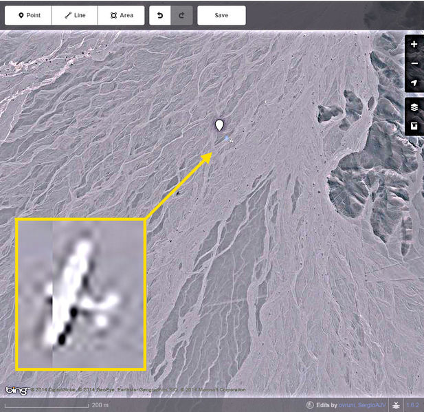
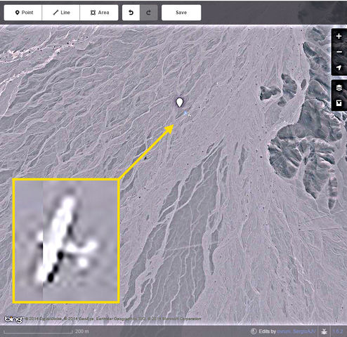
Plane landed in archaeological site of Nazca lines, Peru. Source: Bing image at http://www.openstreetmap.org/edit#map=16/-14.7508/-75.0829. Screen captured and edited in 2015-01-05, by OSMuser SergioAJV.
Licensing
![]()
This file has been released into the public domain by the copyright holder, its copyright has expired, or it is ineligible for copyright. This applies worldwide.
Please, please use more specific template such as {{PD-self}} / {{PD-creator}} / {{PD-shape}} / {{PD-USGov}} / {{PD-old}} / {{PD-RU-exempt}} ... This template is not making clear why this work is in the public domain.
Please, please use more specific template such as {{PD-self}} / {{PD-creator}} / {{PD-shape}} / {{PD-USGov}} / {{PD-old}} / {{PD-RU-exempt}} ... This template is not making clear why this work is in the public domain.
File history
Click on a date/time to view the file as it appeared at that time.
| Date/Time | Thumbnail | Dimensions | User | Comment | |
|---|---|---|---|---|---|
| current | 18:35, 5 January 2015 | | 880 × 855 (240 KB) | SergioAJV (talk | contribs) | Plane landed in archaeological site of Nazca lines, Peru. Source: Bing image at http://www.openstreetmap.org/edit#map=16/-14.7508/-75.0829. Screen captured and edited in 2015-01-05, by OSMuser SergioAJV. |
You cannot overwrite this file.
File usage
There are no pages that use this file.