File:OSM2World 0.1.0 Nikolakloster Passau POV.png
Jump to navigation
Jump to search


Size of this preview: 750 × 600 pixels. Other resolutions: 300 × 240 pixels | 600 × 480 pixels | 960 × 768 pixels | 1,280 × 1,024 pixels.
Original file (1,280 × 1,024 pixels, file size: 559 KB, MIME type: image/png)
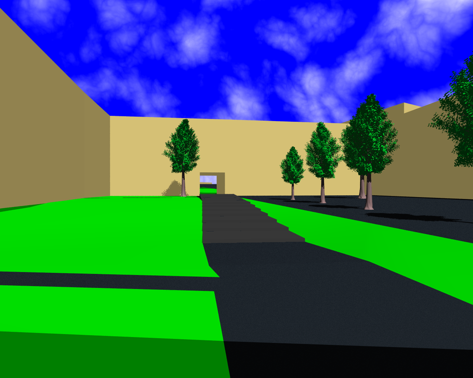
Inner yard of the Nikolakloster in Passau.
This is a 3D rendering of OpenStreetMap data, created using OSM2World, POVRay and some POVRay definitions from osm2pov. Trees were generated by Arbaro.
![]()
![]()
![]()
This work is licensed under the Creative Commons Attribution-ShareAlike 2.0 License.
Attribution not specified as a parameter! THIS LICENSE ALWAYS REQUIRES ATTRIBUTION! Use {{CC-BY-SA-2.0|Attribution, typically name of author}} See Template:CC-BY-SA-2.0 for full description how this template should be used.
Note, there is
There is also
Attribution not specified as a parameter! THIS LICENSE ALWAYS REQUIRES ATTRIBUTION! Use {{CC-BY-SA-2.0|Attribution, typically name of author}} See Template:CC-BY-SA-2.0 for full description how this template should be used.
Note, there is
{{CC-BY-SA-2.0 OpenStreetMap}} for files based on old OSM map data, before the license change made on 2012-09-12.There is also
{{OSM Carto screenshot||old_license}} for files based on old OSM map data, before the license change made on 2012-09-12, created using OSM Carto map style.
File history
Click on a date/time to view the file as it appeared at that time.
| Date/Time | Thumbnail | Dimensions | User | Comment | |
|---|---|---|---|---|---|
| current | 05:18, 25 February 2011 | | 1,280 × 1,024 (559 KB) | Tordanik (talk | contribs) | Inner yard of the [http://www.openstreetmap.org/?lat=48.570496&lon=13.456964&zoom=18 Nikolakloster] in Passau. This is a 3D rendering of OpenStreetMap data, created using OSM2World, [http://www.povray.org/ POVRay] and some POVRay definitions from |
You cannot overwrite this file.
File usage
The following 2 pages use this file: