File:OpenDoorLogistics-UK-sales-map.png
Jump to navigation
Jump to search

No higher resolution available.
OpenDoorLogistics-UK-sales-map.png (422 × 354 pixels, file size: 178 KB, MIME type: image/png)
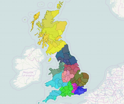
Example sales territory map of the UK created by Open Door Logistics Studio with thematic colouring for territory bricks.
Licensing
| Contains map data © OpenStreetMap contributors, made available under the terms of the Open Database License (ODbL).
The ODbL does not require any particular license for maps produced from ODbL data, produced maps may be subject also to other licences. |
File history
Click on a date/time to view the file as it appeared at that time.
| Date/Time | Thumbnail | Dimensions | User | Comment | |
|---|---|---|---|---|---|
| current | 19:10, 20 October 2014 | | 422 × 354 (178 KB) | Philip Welch (talk | contribs) | Example sales territory map of the UK created by Open Door Logistics Studio with thematic colouring for territory bricks. |
You cannot overwrite this file.
File usage
The following page uses this file: