File:Osmand-2.0-Stuttgart-Hauptbahnhof-OpenRailwayMap-maxspeeds.png
Jump to navigation
Jump to search

Size of this preview: 337 × 599 pixels. Other resolutions: 135 × 240 pixels | 270 × 480 pixels | 720 × 1,280 pixels.
Original file (720 × 1,280 pixels, file size: 702 KB, MIME type: image/png)
Summary
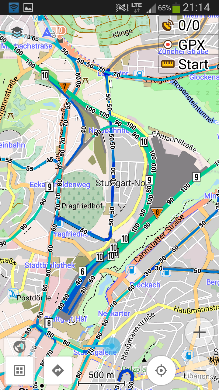
OpenRailwayMap maxspeed layer for Stuttgart Hauptbahnhof (and its surrounding light railways) as an overlay on a standard OsmAnd map. Screenshot taken from Osmand 2.0.5.
Licensing
![]()
This file has been released into the public domain by the copyright holder, its copyright has expired, or it is ineligible for copyright. This applies worldwide.
Please, please use more specific template such as {{PD-self}} / {{PD-creator}} / {{PD-shape}} / {{PD-USGov}} / {{PD-old}} / {{PD-RU-exempt}} ... This template is not making clear why this work is in the public domain.
Please, please use more specific template such as {{PD-self}} / {{PD-creator}} / {{PD-shape}} / {{PD-USGov}} / {{PD-old}} / {{PD-RU-exempt}} ... This template is not making clear why this work is in the public domain.
| Contains map data © OpenStreetMap contributors, made available under the terms of the Open Database License (ODbL).
The ODbL does not require any particular license for maps produced from ODbL data, produced maps may be subject also to other licences. |
File history
Click on a date/time to view the file as it appeared at that time.
| Date/Time | Thumbnail | Dimensions | User | Comment | |
|---|---|---|---|---|---|
| current | 19:34, 4 June 2015 | | 720 × 1,280 (702 KB) | Bigbug21 (talk | contribs) | OpenRailwayMap maxspeed layer for Stuttgart Hauptbahnhof (and its surrounding light railways) as an overlay on a standard OsmAnd map. Screenshot taken from Osmand 2.0.5. Category:OpenRailwayMap |
You cannot overwrite this file.
File usage
The following 9 pages use this file: