File:Outline1.png
Jump to navigation
Jump to search

No higher resolution available.
Outline1.png (800 × 600 pixels, file size: 30 KB, MIME type: image/png)
Summary
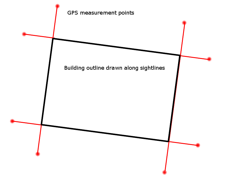
Image showing how using GPS positions captured by extending the sightlines along buildings can then be used to draw the actual building outline. More GPS locations are required to be captured, but GPS position ambiguity is reduced due to being clear of the building obstruction, and also due to the reduction in position error due to mathematical angular error reduction. The further from the building the GPS locations are recorded, less error is introduced into the actual building corner position.
Licensing
![]()
This image or logo only consists of typefaces, individual words, slogans, or simple geometric shapes. These are not eligible for copyright alone because they are not original enough, and thus the image is considered to be in the public domain.
See Public domain or Restricted materials on Wikipedia for more information.
Please note: The public domain status of this work is only in regards to its copyright status. There may be other intellectual property restrictions protecting this image, such as trademarks or design patents if it is a logo.
See
Please note: The public domain status of this work is only in regards to its copyright status. There may be other intellectual property restrictions protecting this image, such as trademarks or design patents if it is a logo.
File history
Click on a date/time to view the file as it appeared at that time.
| Date/Time | Thumbnail | Dimensions | User | Comment | |
|---|---|---|---|---|---|
| current | 16:36, 6 April 2013 | | 800 × 600 (30 KB) | Ve6srv (talk | contribs) | Image showing how using GPS positions captured by extending the sightlines along buildings can then be used to draw the actual building outline. More GPS locations are required to be captured, but GPS position ambiguity is reduced due to being clear of... |
You cannot overwrite this file.
File usage
The following page uses this file: