File:Pasay boundaries.png
Jump to navigation
Jump to search


Size of this preview: 558 × 600 pixels. Other resolutions: 223 × 240 pixels | 447 × 480 pixels | 715 × 768 pixels | 953 × 1,024 pixels | 1,364 × 1,466 pixels.
Original file (1,364 × 1,466 pixels, file size: 326 KB, MIME type: image/png)
Information
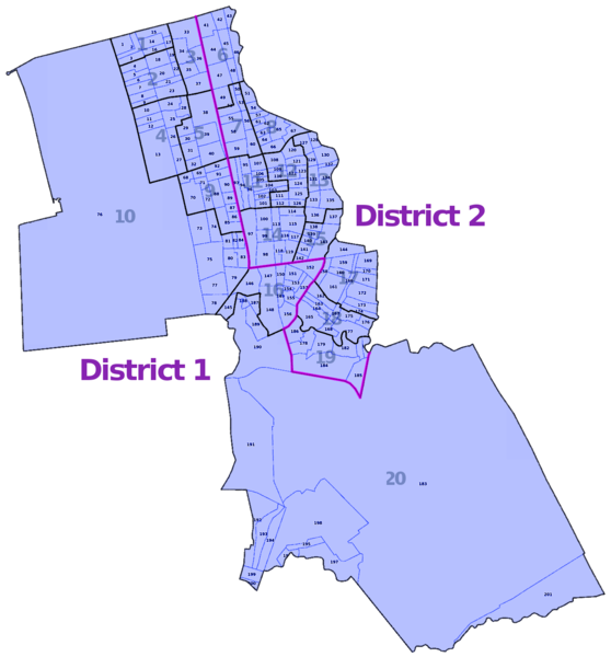
| Description | Administrative boundaries of Pasay showing its 20 zones and 201 barangays |
|---|---|
| Author | seav |
| Source | Image derived from layers provided by OpenStreetMap France map layers service |
| Date | 2013-10-09 |
| Permission | CC BY-SA 2.0 |
File history
Click on a date/time to view the file as it appeared at that time.
| Date/Time | Thumbnail | Dimensions | User | Comment | |
|---|---|---|---|---|---|
| current | 05:16, 27 October 2013 | | 1,364 × 1,466 (326 KB) | Seav (talk | contribs) | Added district boundary |
| 18:43, 8 October 2013 | 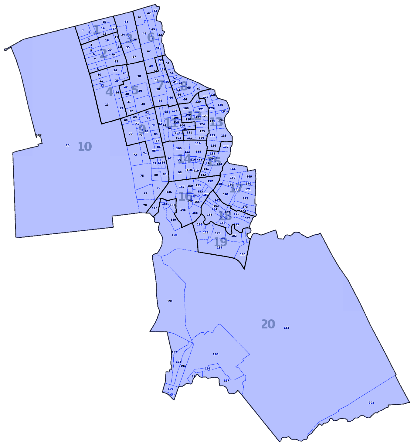 | 1,364 × 1,466 (313 KB) | Seav (talk | contribs) | ==Information== {{Information |Description = Administrative boundaries of Pasay showing its 20 zones and 201 barangays |Source = Image derived from layers provided by [http://layers.openstreetmap.fr/?zoom=14&lat=14.53172&lon=121.00516&layers... |
You cannot overwrite this file.
File usage
The following file is a duplicate of this file (more details):
- File:Pasay City zones and barangays.png from Wikimedia Commons
The following page uses this file: