File:Photo 2020-02-04 16-41-33.jpg
Jump to navigation
Jump to search

Size of this preview: 600 × 600 pixels. Other resolutions: 240 × 240 pixels | 480 × 480 pixels | 768 × 768 pixels | 1,024 × 1,024 pixels | 1,280 × 1,280 pixels.
Original file (1,280 × 1,280 pixels, file size: 338 KB, MIME type: image/jpeg)
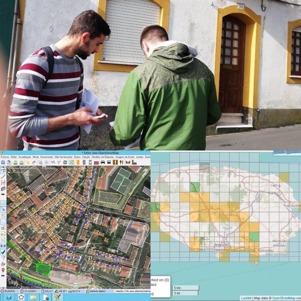
By using Field Papers and some mobile apps (like GoMap!; StreetComplete; KeyPadMapper; OSMTracker; ...) we map the street names and housing numbers in Angra do Heroísmo.
File history
Click on a date/time to view the file as it appeared at that time.
| Date/Time | Thumbnail | Dimensions | User | Comment | |
|---|---|---|---|---|---|
| current | 15:47, 5 February 2020 | | 1,280 × 1,280 (338 KB) | Nunoazevedo (talk | contribs) |
You cannot overwrite this file.
File usage
The following page uses this file: