File:Pinelands.png
Jump to navigation
Jump to search


Size of this preview: 648 × 600 pixels. Other resolutions: 259 × 240 pixels | 519 × 480 pixels | 830 × 768 pixels | 1,139 × 1,054 pixels.
Original file (1,139 × 1,054 pixels, file size: 754 KB, MIME type: image/png)
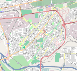
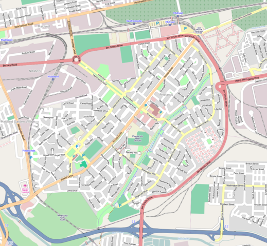
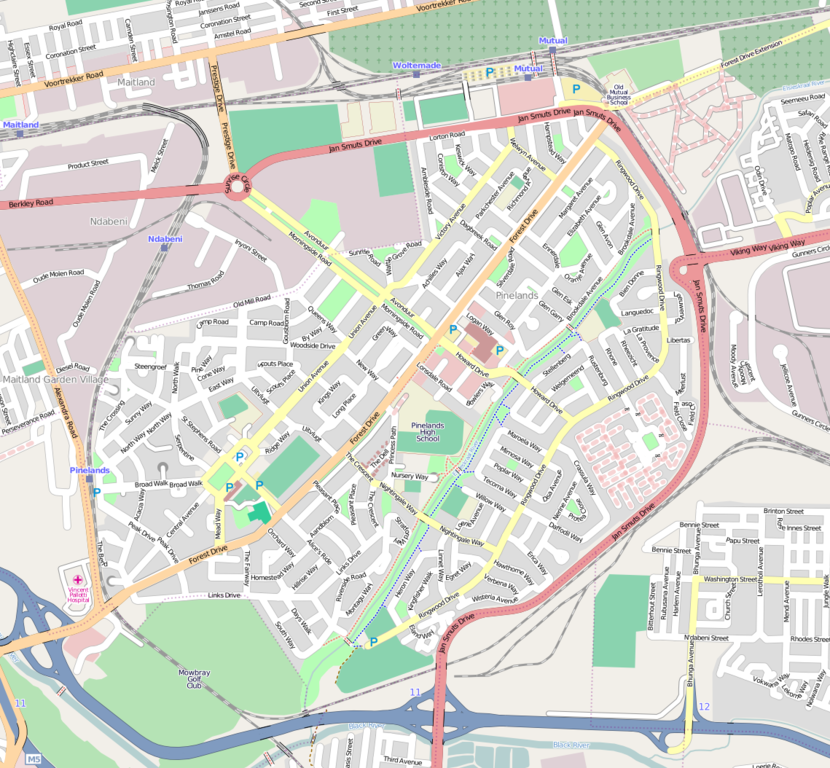
OpenStreetMap of Pinelands, Cape Town.
This is a Featured image, which means that it has been identified as one of the best examples of OpenStreetMap mapping, or that it provides a useful illustration of the OpenStreetMap project. If you know another image of similar quality, you can nominate it on Featured image proposals.
Front-page image on 15 Dec 2007
Licensing
![]()
![]()
![]()
This screenshot contains OpenStreetMap Carto rendering.
The OpenStreetMap Carto map style is made available under the Creative Commons CC-0 1.0 Universal Public Domain Dedication.
- Attribution to the map data:
![]()
Contains map data © OpenStreetMap contributors, made available under the terms of the Creative Commons Attribution-ShareAlike 2.0 (CC-BY-SA-2.0).
File history
Click on a date/time to view the file as it appeared at that time.
| Date/Time | Thumbnail | Dimensions | User | Comment | |
|---|---|---|---|---|---|
| current | 11:40, 7 February 2009 | | 1,139 × 1,054 (754 KB) | Htonl (talk | contribs) | update |
| 18:48, 3 November 2008 | 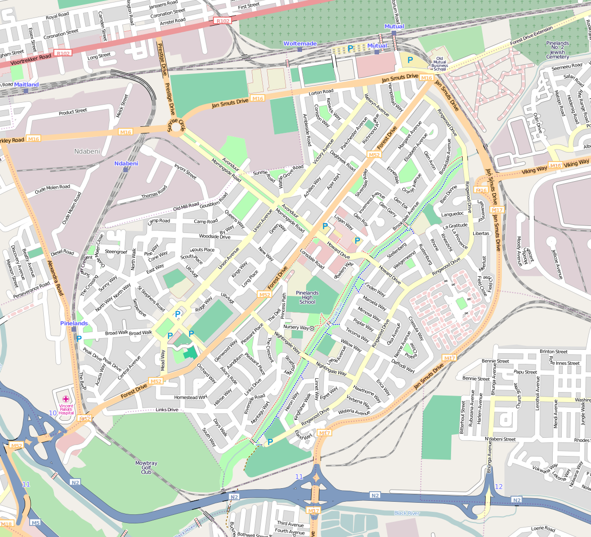 | 1,174 × 1,067 (784 KB) | Htonl (talk | contribs) | new style | |
| 09:14, 27 April 2008 | 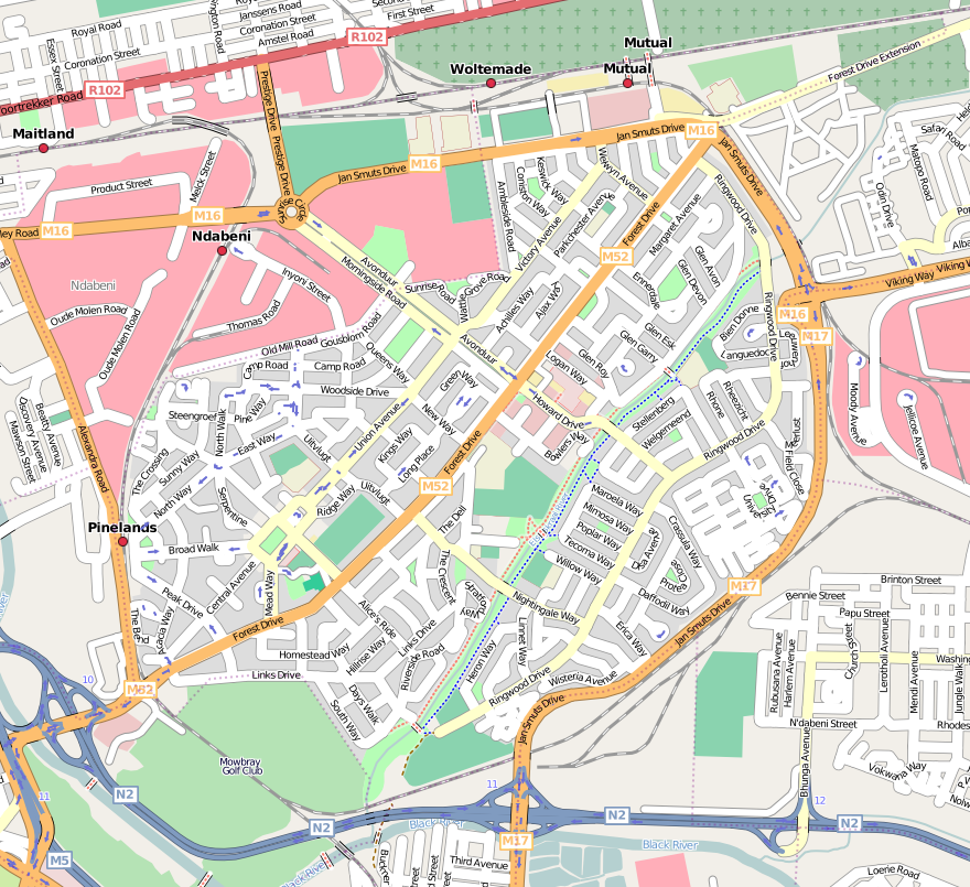 | 880 × 805 (537 KB) | Htonl (talk | contribs) | update, mapnik version | |
| 23:57, 28 November 2007 | 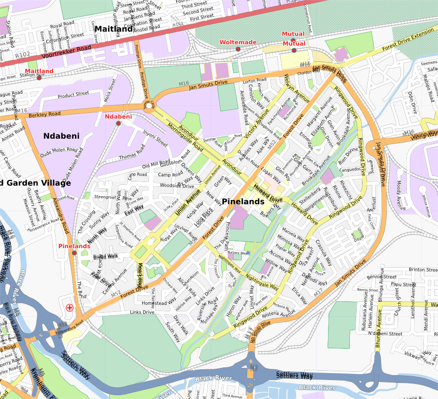 | 900 × 820 (758 KB) | Htonl (talk | contribs) | updated | |
| 15:04, 21 October 2007 | 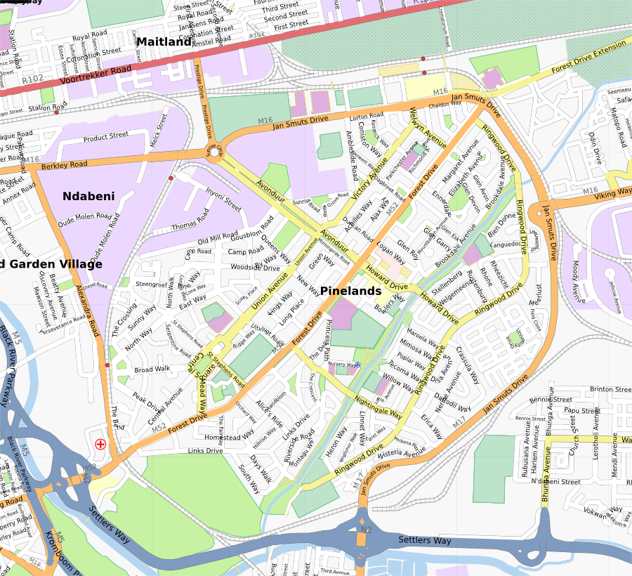 | 900 × 820 (730 KB) | Htonl (talk | contribs) | update | |
| 02:14, 14 September 2007 | 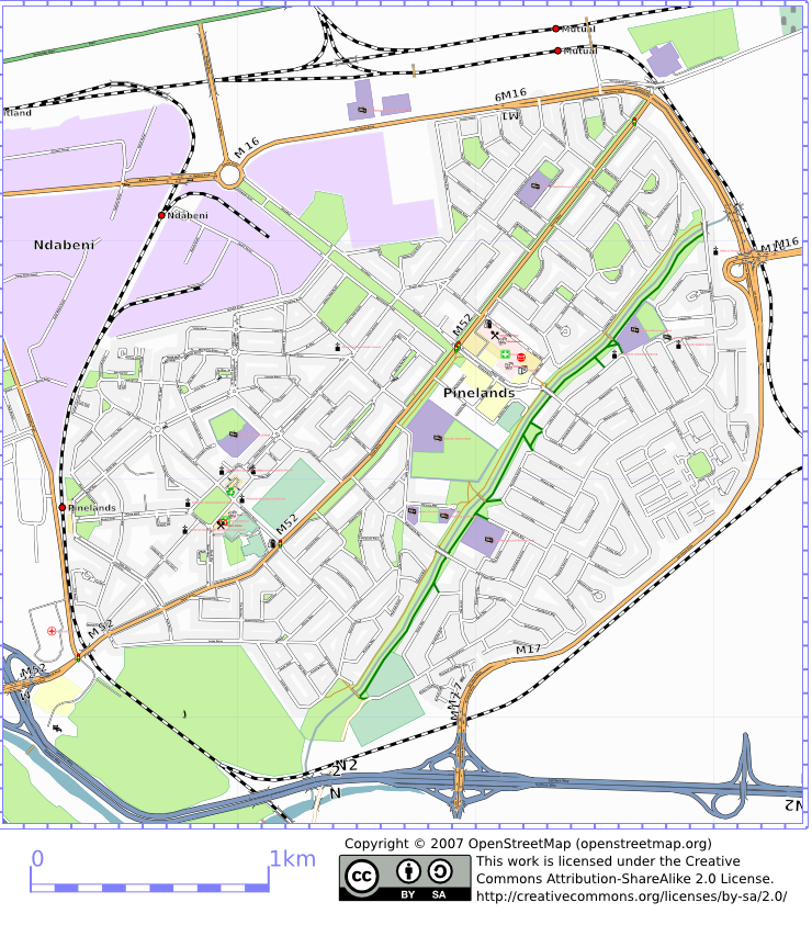 | 740 × 843 (517 KB) | Htonl (talk | contribs) | osmarender of Pinelands, Cape Town |
You cannot overwrite this file.
File usage
The following 5 pages use this file: