File:Pipeline Measuring Point.jpg
Jump to navigation
Jump to search


Size of this preview: 450 × 600 pixels. Other resolutions: 180 × 240 pixels | 360 × 480 pixels | 576 × 768 pixels | 768 × 1,024 pixels | 2,448 × 3,264 pixels.
Original file (2,448 × 3,264 pixels, file size: 1.66 MB, MIME type: image/jpeg)
Summary
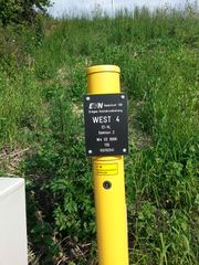
Corrosion Measuring Point of the West 4 pipeline.
Licensing
- This media file was uploaded by author of the work and its copyright holder.
![]()
![]()
This work is licensed under the Creative Commons Attribution 4.0 License.
Attribution: Rfuegen
Attribution: Rfuegen
File history
Click on a date/time to view the file as it appeared at that time.
| Date/Time | Thumbnail | Dimensions | User | Comment | |
|---|---|---|---|---|---|
| current | 01:09, 12 October 2013 | | 2,448 × 3,264 (1.66 MB) | Rfuegen (talk | contribs) | Corrosion Measuring Point of the West 4 pipeline. |
You cannot overwrite this file.
File usage
The following 12 pages use this file: