File:Plan de la ville de Rennes (F. Forestier, 1726).jpg
Jump to navigation
Jump to search


Size of this preview: 704 × 599 pixels. Other resolutions: 282 × 240 pixels | 564 × 480 pixels | 902 × 768 pixels | 1,203 × 1,024 pixels | 2,406 × 2,048 pixels | 6,160 × 5,243 pixels.
Original file (6,160 × 5,243 pixels, file size: 7.07 MB, MIME type: image/jpeg)
This file and its description are from Wikimedia Commons.
Summary
| Description |
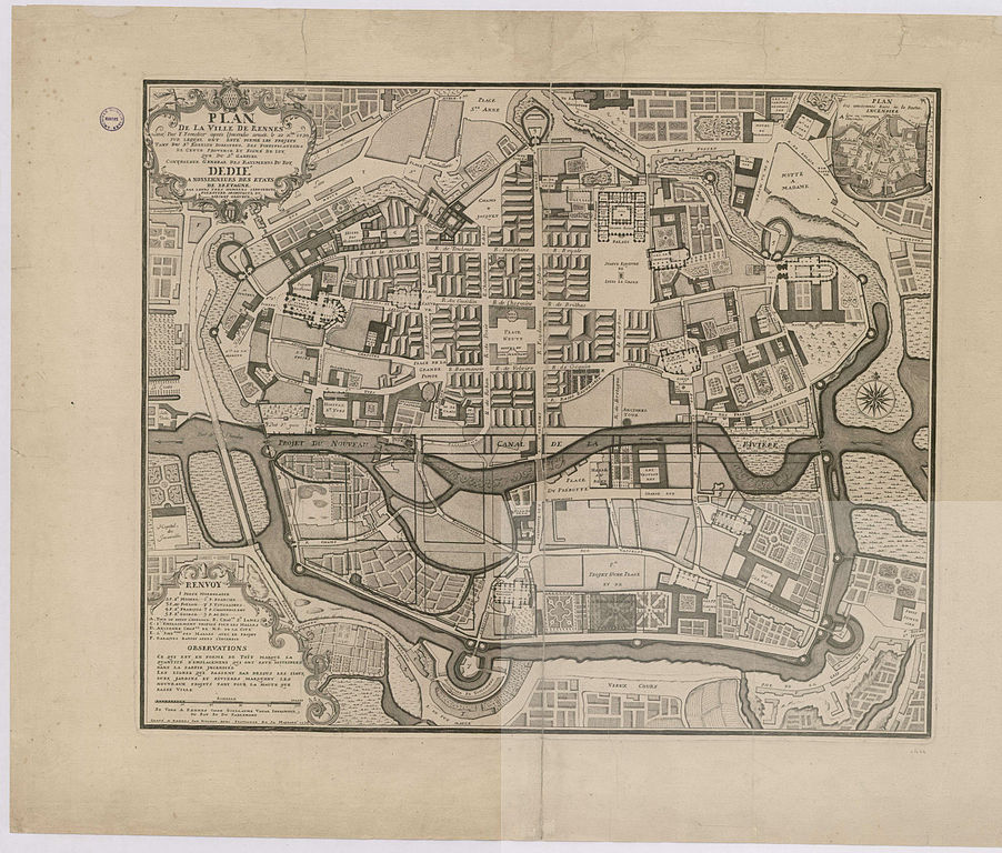
Français : Plan de la ville de Rennes levé par F. Forestier après l'incendie arrivé le 22 décembre 1720, sur lequel ont été formés les projets tant du Sieur Robelin directeur des fortifications de cette province et signés de lui, que du Sieur Gabriel contrôleur général des bâtiments du roi, dédié à nosseigneurs des États de Bretagne, par leurs très humbles serviteurs Forestier architecte et Robinet graveur. |
||||||||||||||||
| Date | |||||||||||||||||
| Source |
|
||||||||||||||||
| Author | F. Forestier | ||||||||||||||||
Licensing
|
This work is in the public domain in its country of origin and other countries and areas where the copyright term is the author's life plus 100 years or fewer. | |
| This file has been identified as being free of known restrictions under copyright law, including all related and neighboring rights. | |
File history
Click on a date/time to view the file as it appeared at that time.
| Date/Time | Thumbnail | Dimensions | User | Comment | |
|---|---|---|---|---|---|
| current | 06:40, 28 January 2013 | | 6,160 × 5,243 (7.07 MB) | wikimediacommons>Slick-o-bot | Bot: convert to a non-interlaced jpeg (see bug #17645) |
File usage
The following page uses this file:
.jpg)