File:Plan mediaeval manor.jpg
Jump to navigation
Jump to search

Size of this preview: 406 × 600 pixels. Other resolutions: 162 × 240 pixels | 325 × 480 pixels | 520 × 768 pixels | 693 × 1,024 pixels | 1,458 × 2,154 pixels.
Original file (1,458 × 2,154 pixels, file size: 1.84 MB, MIME type: image/jpeg)
This file and its description are from Wikimedia Commons.
Summary
| Description |
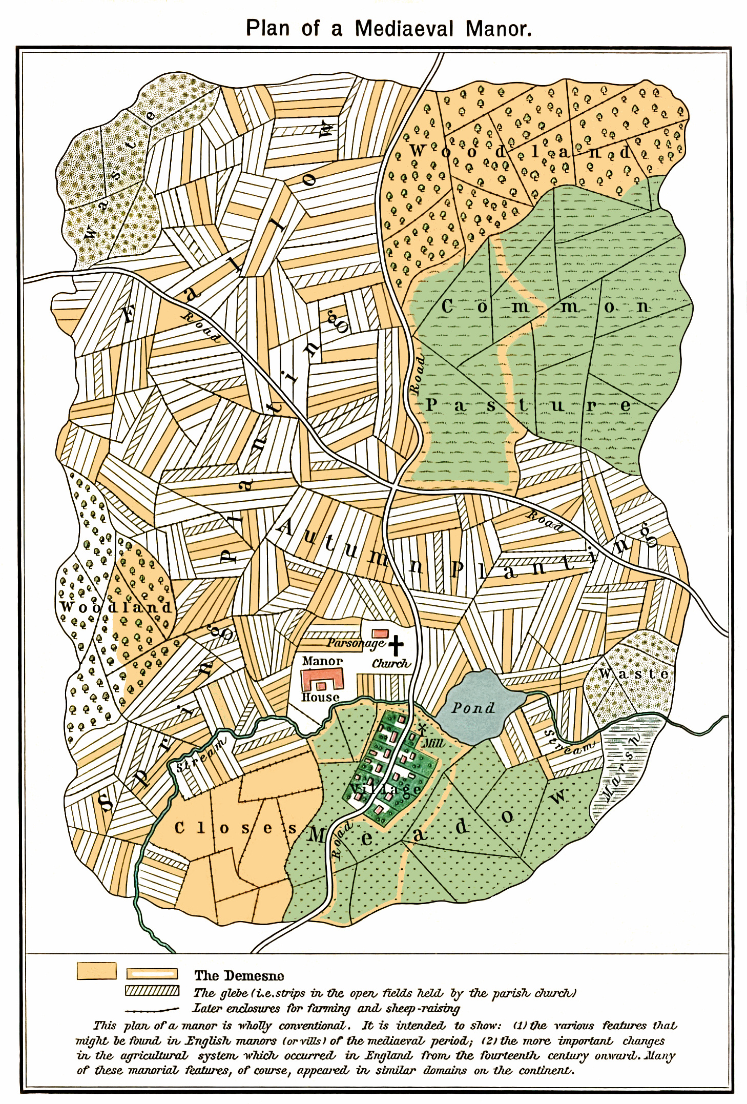
Plan of a fictional mediaeval manor The mustard-colored areas are part of the demesne, the hatched areas part of the glebe. |
| Date | |
| Source | [1] |
| Author | William R. Shepherd, Historical Atlas, New York, Henry Holt and Company, 1923 |
| Permission (Reusing this file) |
Author died in 1934 |
| Other versions | Derivative works of this file: Medieval Open Field System.JPG |
Licensing
This media file is in the public domain in the United States. This applies to U.S. works where the copyright has expired, often because its first publication occurred prior to January 1, 1929, and if not then due to lack of notice or renewal. See this page for further explanation.
|
 | |
 |
This image might not be in the public domain outside of the United States; this especially applies in the countries and areas that do not apply the rule of the shorter term for US works, such as Canada, Mainland China (not Hong Kong or Macao), Germany, Mexico, and Switzerland. The creator and year of publication are essential information and must be provided. See Wikipedia:Public domain and Wikipedia:Copyrights for more details.
|
| Annotations | This image is annotated: View the annotations at Commons |
File history
Click on a date/time to view the file as it appeared at that time.
| Date/Time | Thumbnail | Dimensions | User | Comment | |
|---|---|---|---|---|---|
| current | 17:58, 16 February 2011 | | 1,458 × 2,154 (1.84 MB) | wikimediacommons>Smalljim | A complete clean up |
File usage
The following page uses this file: