File:Plantuml-teren sportowy.svg
Jump to navigation
Jump to search

Size of this PNG preview of this SVG file: 691 × 319 pixels. Other resolutions: 320 × 148 pixels | 640 × 295 pixels | 1,024 × 473 pixels | 1,280 × 591 pixels.
Original file (SVG file, nominally 691 × 319 pixels, file size: 12 KB)
Source code
Generated with PlantUML from following code:
' Diagram for sport center tagging (PL)
' 2022 Author: https://osm.org/user/kubahahaha
' This code is published under WTFPL Public Licence version 2
@startuml
allow_mixing
skinparam class {
BorderColor<<Area>> Blue
BorderColor<<Node>> Red
}
hide stereotype
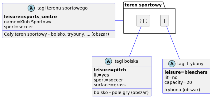
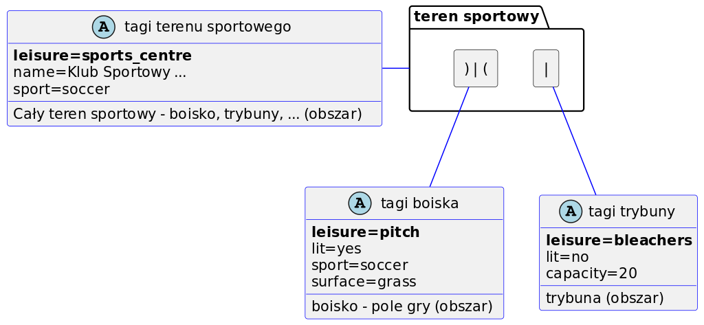
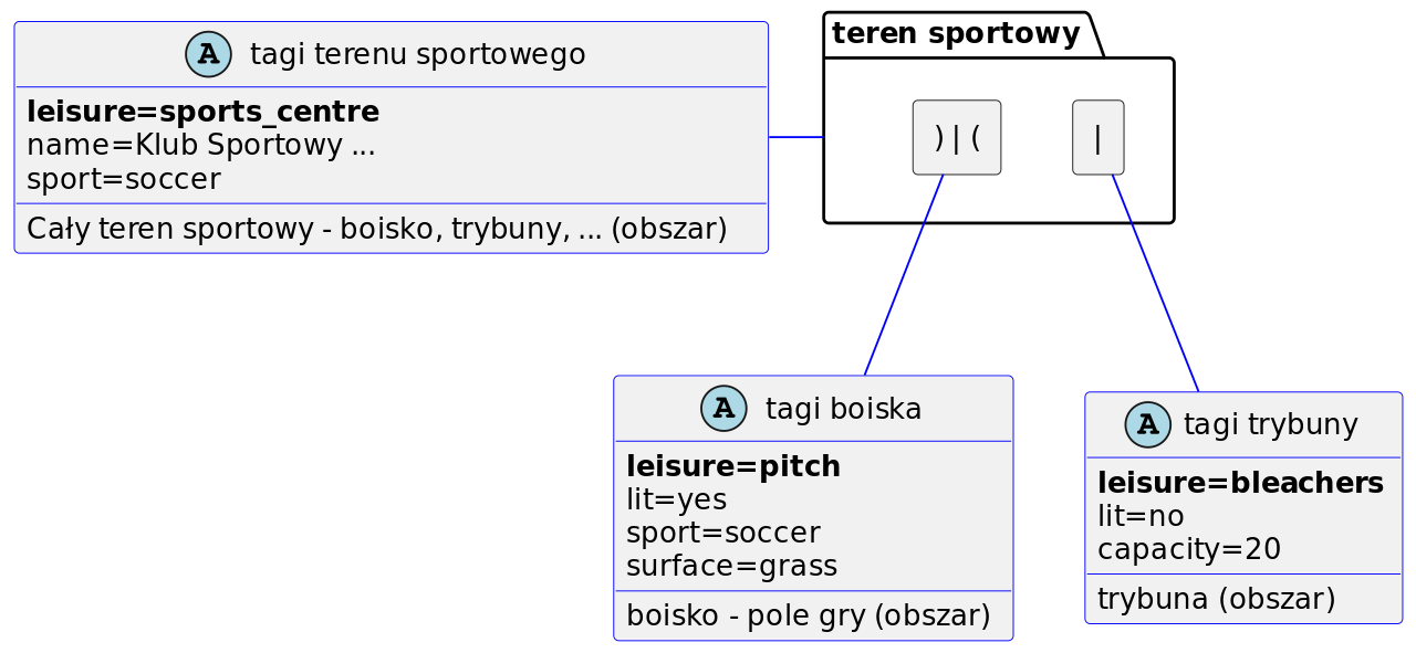
package "teren sportowy" {
rectangle ") | (" AS boisko <<Folder>>
rectangle "|" AS trybuna <<Folder>>
}
class "tagi boiska" <<(A,lightblue) Area>> {
**leisure=pitch**
lit=yes
sport=soccer
surface=grass
boisko - pole gry (obszar)
}
class "tagi trybuny" <<(A,lightblue) Area>> {
**leisure=bleachers**
lit=no
capacity=20
trybuna (obszar)
}
class "tagi terenu sportowego" <<(A,lightblue) Area>> {
**leisure=sports_centre**
name=Klub Sportowy ...
sport=soccer
Cały teren sportowy - boisko, trybuny, ... (obszar)
}
"tagi terenu sportowego" - "teren sportowy" #blue
boisko -- "tagi boiska" #blue
trybuna -- "tagi trybuny" #blue
@enduml
Licensing
Source code and produced image is licenced under WTFPL Public Licence version 2 (full text).
- This media file was uploaded by author of the work and its copyright holder.
![]()
Permission is granted to do what the fuck you want to with this document under the terms of the WTF Public License, Version 2.
File history
Click on a date/time to view the file as it appeared at that time.
| Date/Time | Thumbnail | Dimensions | User | Comment | |
|---|---|---|---|---|---|
| current | 13:53, 2 September 2022 | | 691 × 319 (12 KB) | Kubahaha (talk | contribs) | {{Information | description= | source= | date= | author= | permission= | other_versions= }} |
You cannot overwrite this file.
File usage
There are no pages that use this file.