File:Power line-in-usa.png
Jump to navigation
Jump to search


Size of this preview: 800 × 437 pixels. Other resolutions: 320 × 175 pixels | 640 × 350 pixels | 1,263 × 690 pixels.
Original file (1,263 × 690 pixels, file size: 241 KB, MIME type: image/png)
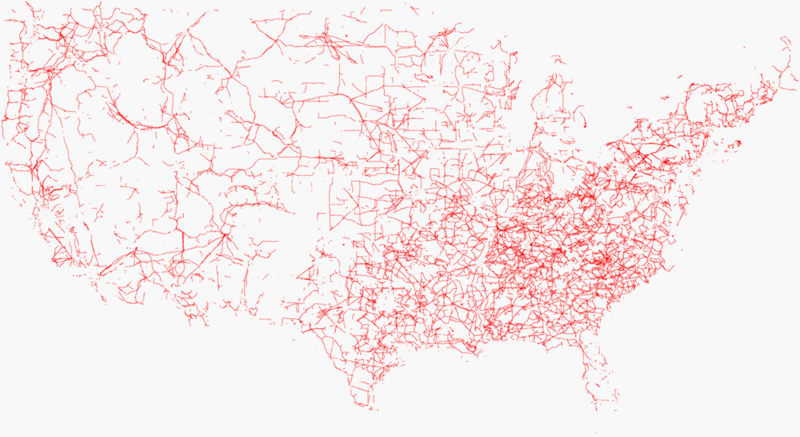
Power lines in the USA. Data selected with osmxapi (whole world > 350 MB: http://www.informationfreeway.org/api/0.5/way[power=line]) and rendered by Kosmos with Kosmos Power Rules.
This is a Featured image, which means that it has been identified as one of the best examples of OpenStreetMap mapping, or that it provides a useful illustration of the OpenStreetMap project. If you know another image of similar quality, you can nominate it on Featured image proposals.
Front-page image on 14 Jun 2008
![]()
Contains map data © OpenStreetMap contributors, made available under the terms of the Creative Commons Attribution-ShareAlike 2.0 (CC-BY-SA-2.0).
File history
Click on a date/time to view the file as it appeared at that time.
| Date/Time | Thumbnail | Dimensions | User | Comment | |
|---|---|---|---|---|---|
| current | 09:21, 4 April 2008 | | 1,263 × 690 (241 KB) | Bahnpirat (talk | contribs) | Power lines in the USA. Data selected with osmxapi (whole world > 300 MB: <nowiki>http://www.informationfreeway.org/api/0.5/way[power=line]</nowiki>) and rendered by Kosmos with special render file:<br />Power || {{IconWay}} || {{tag|power|line}} |
You cannot overwrite this file.
File usage
The following 3 pages use this file: