File:Progress of buildings in Nordland, Norway.png
Jump to navigation
Jump to search

Size of this preview: 412 × 599 pixels. Other resolutions: 165 × 240 pixels | 330 × 480 pixels | 528 × 768 pixels | 705 × 1,024 pixels | 1,707 × 2,480 pixels.
Original file (1,707 × 2,480 pixels, file size: 1.45 MB, MIME type: image/png)
Description
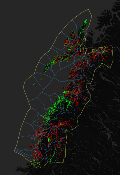
Progress of mapping buildings in Nordland, Norway.
How-to
Made with QGis by querying with these scripts in Overpass;
//overpass plugin in QGis does not support center. queried on overpass-turbo.eu and exported as geojson
[out:json][timeout:25];
{{geocodeArea:Nordland}}->.searchArea;
(
way["building"](area.searchArea);
relation["building"](area.searchArea);
);
out center;
>;
[out:json][timeout:25];
{{geocodeArea:Nordland}}->.searchArea;
(
  node["addr:housenumber"](area.searchArea);
);
out skel;
>;
Sources
Basemap: Map tiles by Carto, under CC BY 3.0. Data by OpenStreetMap, under ODbL.
Points imported: © OpenStreetMap contributors
Licensing
![]()
![]()
This work is licensed under the Creative Commons Attribution 3.0 License.
Attribution not specified as a parameter! THIS LICENSE ALWAYS REQUIRES ATTRIBUTION! Use {{CC-BY-3.0|Attribution, typically name of author}} See Template:CC-BY-3.0 for full description how this template should be used.
Attribution not specified as a parameter! THIS LICENSE ALWAYS REQUIRES ATTRIBUTION! Use {{CC-BY-3.0|Attribution, typically name of author}} See Template:CC-BY-3.0 for full description how this template should be used.
| Contains map data © OpenStreetMap contributors, made available under the terms of the Open Database License (ODbL).
The ODbL does not require any particular license for maps produced from ODbL data, produced maps may be subject also to other licences. |
File history
Click on a date/time to view the file as it appeared at that time.
| Date/Time | Thumbnail | Dimensions | User | Comment | |
|---|---|---|---|---|---|
| current | 16:47, 16 September 2020 | | 1,707 × 2,480 (1.45 MB) | Sssandum (talk | contribs) | Updated data |
| 12:22, 26 July 2020 |  | 1,707 × 2,480 (1.45 MB) | Sssandum (talk | contribs) |
You cannot overwrite this file.
File usage
There are no pages that use this file.