File:Qcad export vectoriel.png
Jump to navigation
Jump to search

Size of this preview: 613 × 600 pixels. Other resolutions: 245 × 240 pixels | 490 × 480 pixels | 893 × 874 pixels.
Original file (893 × 874 pixels, file size: 109 KB, MIME type: image/png)
Summary
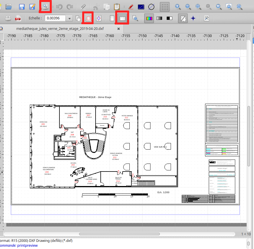
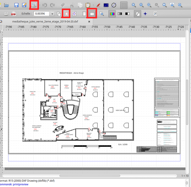
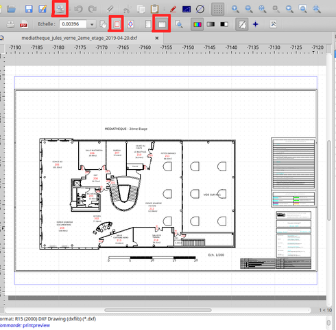
Exporter le plan de bâti en format SVG avec QCAD.
Licensing
- This media file was uploaded by author of the work and its copyright holder.
![]()
![]()
![]()
This work is licensed under the Creative Commons Attribution-ShareAlike 4.0 License.
Attribution: Axelos
Attribution: Axelos
File history
Click on a date/time to view the file as it appeared at that time.
| Date/Time | Thumbnail | Dimensions | User | Comment | |
|---|---|---|---|---|---|
| current | 16:34, 25 July 2019 | | 893 × 874 (109 KB) | Axelos (talk | contribs) | Exporter le plan de bâti en format SVG avec QCAD. |
You cannot overwrite this file.
File usage
The following page uses this file: