File:Radazul buildings.gif
Jump to navigation
Jump to search

Size of this preview: 800 × 597 pixels. Other resolutions: 320 × 239 pixels | 640 × 477 pixels | 893 × 666 pixels.
Original file (893 × 666 pixels, file size: 321 KB, MIME type: image/gif, looped, 2 frames, 6.0 s)
Summary
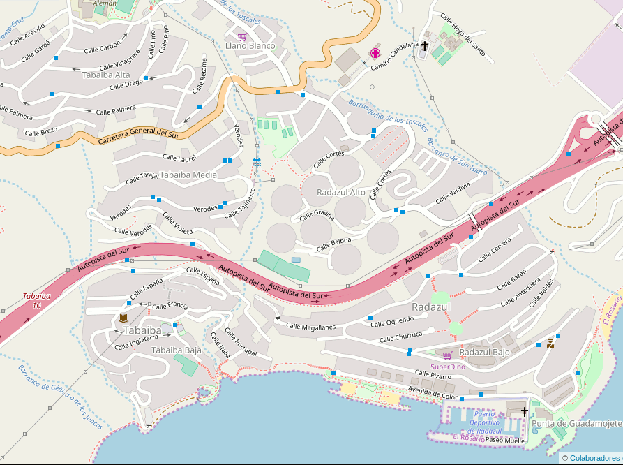
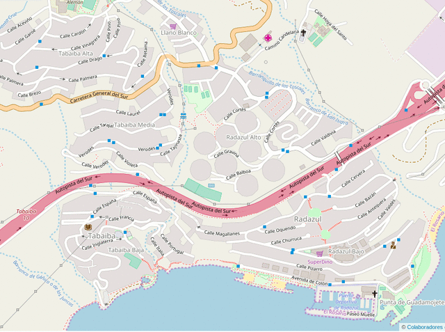
Spanish Cadastre building import in La Esperanza, Tenerife.
Licensing
![]()
![]()
This screenshot contains OpenStreetMap Carto rendering.
The OpenStreetMap Carto map style is made available under the Creative Commons CC-0 1.0 Universal Public Domain Dedication.
- Attribution to the map data:
| Contains map data © OpenStreetMap contributors, made available under the terms of the Open Database License (ODbL).
The ODbL does not require any particular license for maps produced from ODbL data, produced maps may be subject also to other licences. |
File history
Click on a date/time to view the file as it appeared at that time.
| Date/Time | Thumbnail | Dimensions | User | Comment | |
|---|---|---|---|---|---|
| current | 22:35, 7 March 2018 | | 893 × 666 (321 KB) | Javiersanp (talk | contribs) | Spanish Cadastre building import in La Esperanza, Tenerife. |
You cannot overwrite this file.
File usage
The following 2 pages use this file: