File:Radrevier ruhr tabelle neu.pdf
Jump to navigation
Jump to search
 Size of this JPG preview of this PDF file: 800 × 566 pixels. Other resolutions: 320 × 226 pixels | 640 × 452 pixels | 1,024 × 724 pixels | 1,280 × 905 pixels | 2,481 × 1,754 pixels. |
Original file (2,481 × 1,754 pixels, file size: 112 KB, MIME type: application/pdf, 7 pages)
Summary
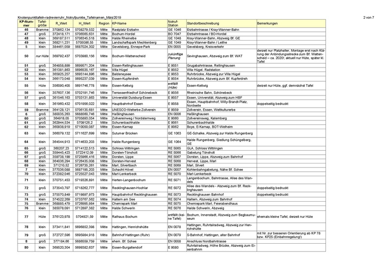
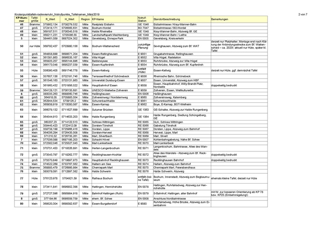
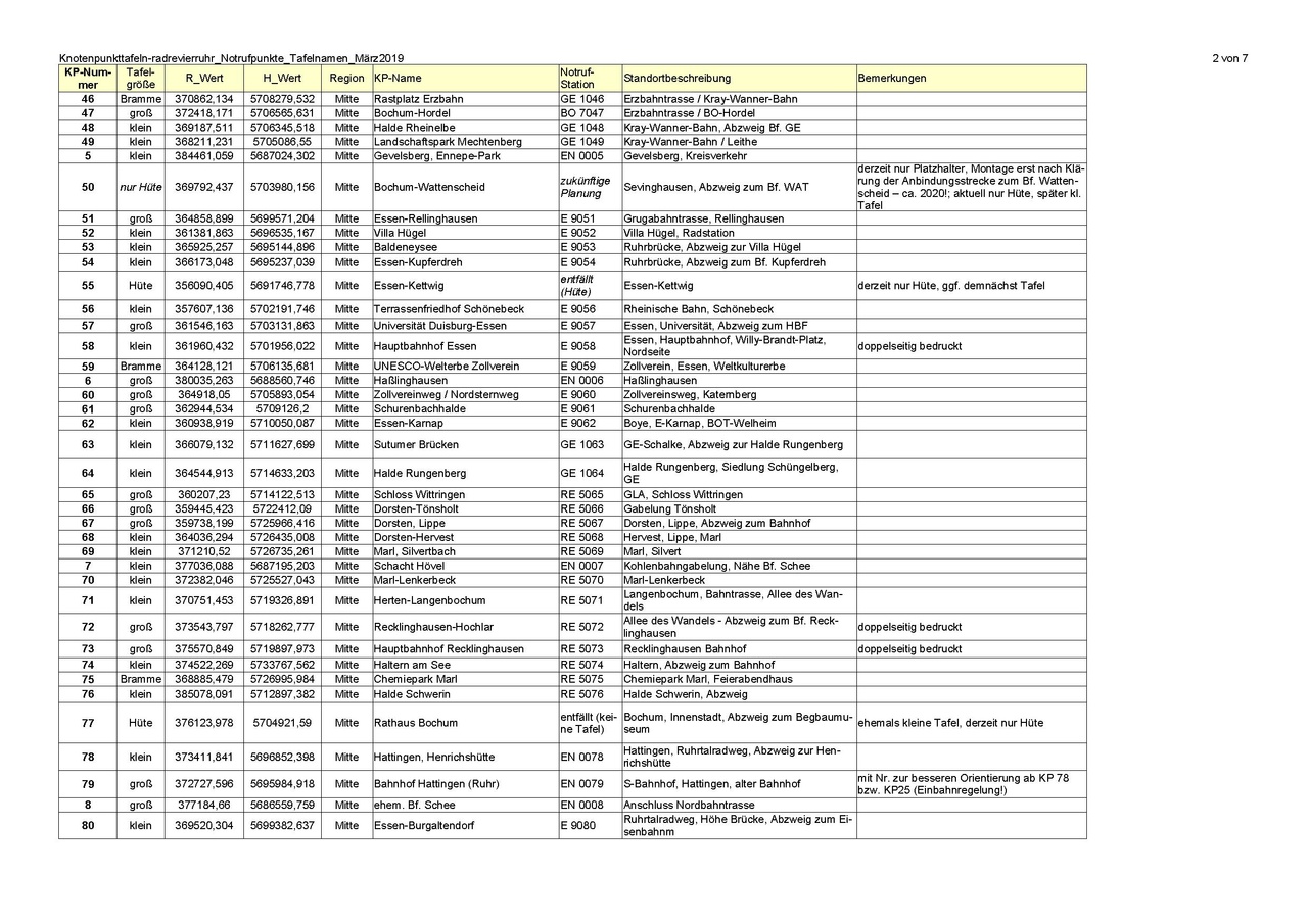
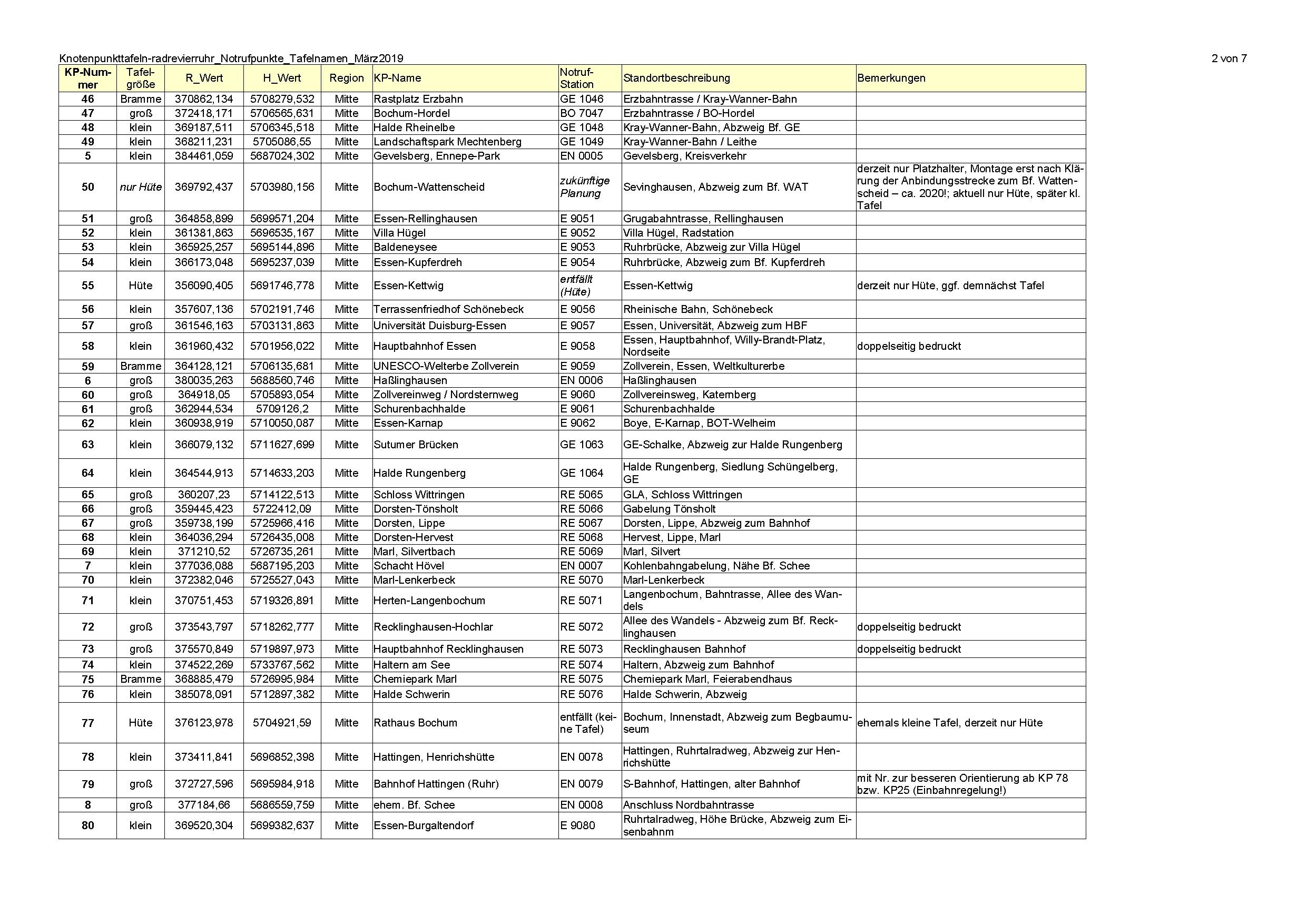
Ergänzende Informationen und Korrekturen zum Knotenpunktsystem radrevier.ruhr, danke an Ersteller User:Grischa
Licensing
![]()
This file has been released into the public domain by the copyright holder, its copyright has expired, or it is ineligible for copyright. This applies worldwide.
Please, please use more specific template such as {{PD-self}} / {{PD-creator}} / {{PD-shape}} / {{PD-USGov}} / {{PD-old}} / {{PD-RU-exempt}} ... This template is not making clear why this work is in the public domain.
Please, please use more specific template such as {{PD-self}} / {{PD-creator}} / {{PD-shape}} / {{PD-USGov}} / {{PD-old}} / {{PD-RU-exempt}} ... This template is not making clear why this work is in the public domain.
File history
Click on a date/time to view the file as it appeared at that time.
| Date/Time | Thumbnail | Dimensions | User | Comment | |
|---|---|---|---|---|---|
| current | 22:46, 11 March 2019 |  | 2,481 × 1,754, 7 pages (112 KB) | D3d9ex (talk | contribs) | Ergänzende Informationen und Korrekturen zum Knotenpunktsystem radrevier.ruhr, danke an Ersteller User:Grischa |
You cannot overwrite this file.
File usage
There are no pages that use this file.