File:Radroutenwegweisung Weimar.jpg
Jump to navigation
Jump to search


Size of this preview: 800 × 533 pixels. Other resolutions: 320 × 213 pixels | 640 × 427 pixels | 1,024 × 683 pixels | 1,280 × 853 pixels | 1,536 × 1,024 pixels.
Original file (1,536 × 1,024 pixels, file size: 831 KB, MIME type: image/jpeg)
Summary
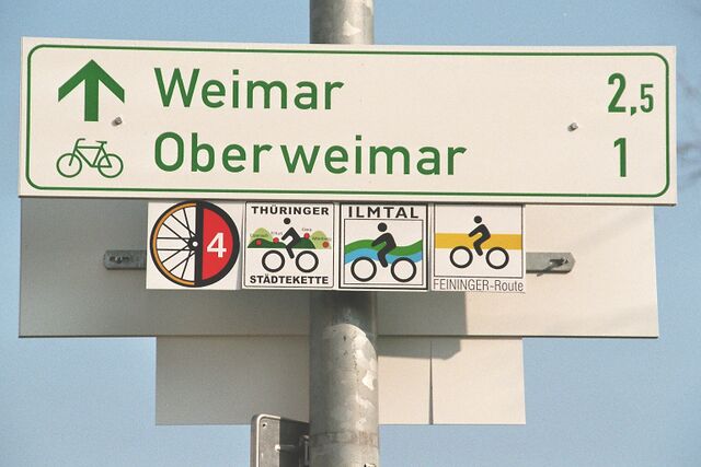
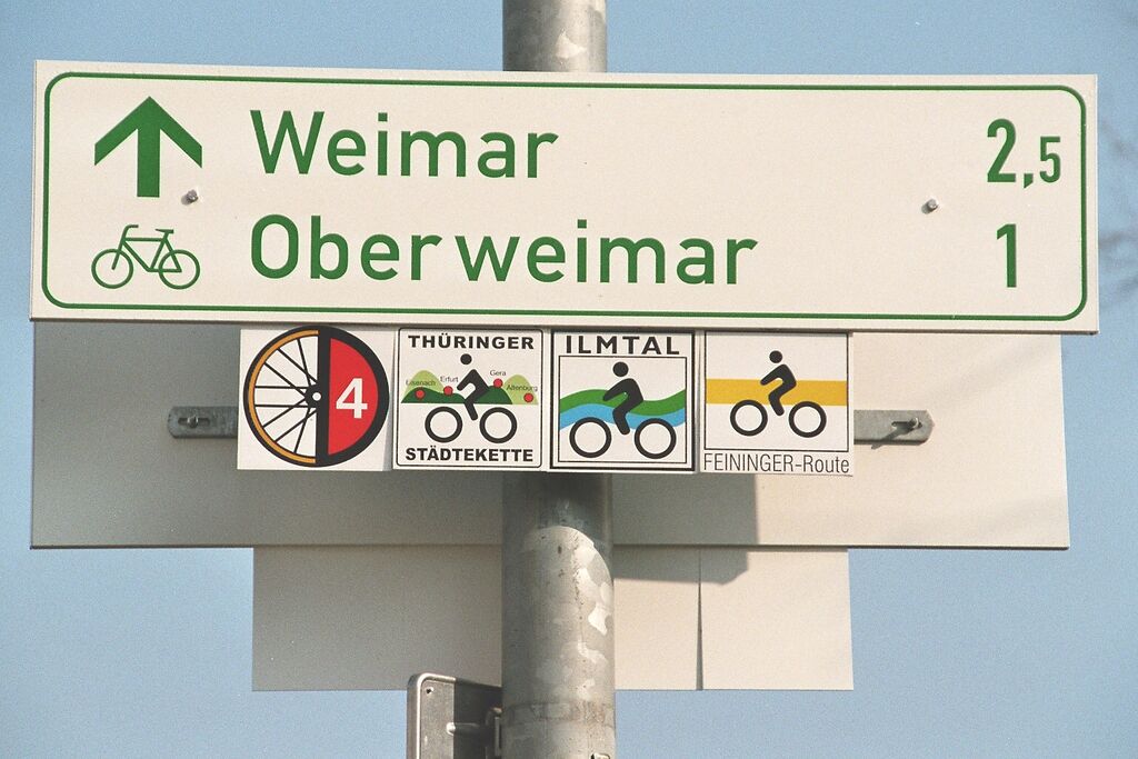
Beispiel zur Ausschilderung verschiedener Radrouten an einem Rad-Wegweiser mittels Einschübe (D-Route, regionale Route, lokale Route)
Selbsterstelltes Foto nahe Weimar (Thüringen).
Licensing
![]()
This file has been released into the public domain by the copyright holder, its copyright has expired, or it is ineligible for copyright. This applies worldwide.
Please, please use more specific template such as {{PD-self}} / {{PD-creator}} / {{PD-shape}} / {{PD-USGov}} / {{PD-old}} / {{PD-RU-exempt}} ... This template is not making clear why this work is in the public domain.
Please, please use more specific template such as {{PD-self}} / {{PD-creator}} / {{PD-shape}} / {{PD-USGov}} / {{PD-old}} / {{PD-RU-exempt}} ... This template is not making clear why this work is in the public domain.
File history
Click on a date/time to view the file as it appeared at that time.
| Date/Time | Thumbnail | Dimensions | User | Comment | |
|---|---|---|---|---|---|
| current | 00:05, 28 December 2019 | | 1,536 × 1,024 (831 KB) | JochenB (talk | contribs) | etwas aufgehellt |
| 23:58, 27 December 2019 | 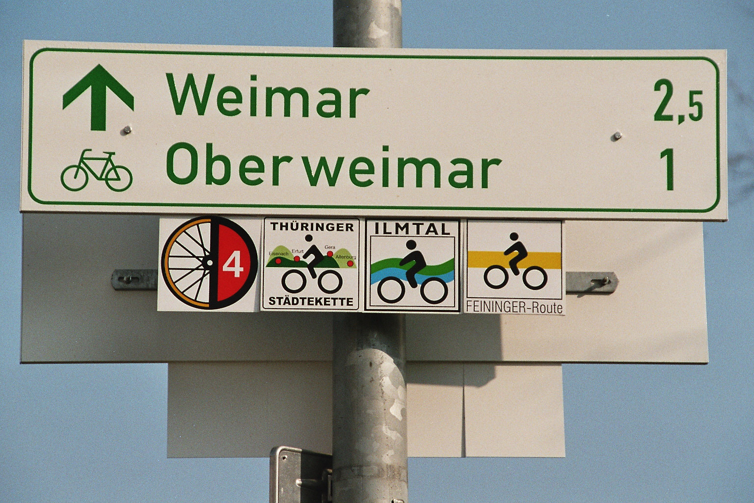 | 1,536 × 1,024 (856 KB) | JochenB (talk | contribs) | Beispiel zur Ausschilderung verschiedener Radrouten an einem Rad-Wegweiser mittels Einschübe (D-Route, regionale Route, lokale Route) Selbsterstelltes Foto nahe Weimar (Thüringen). |
You cannot overwrite this file.
File usage
The following 4 pages use this file: