File:Raised intersection, bird perspective.png
Jump to navigation
Jump to search

No higher resolution available.
Raised_intersection,_bird_perspective.png (497 × 480 pixels, file size: 63 KB, MIME type: image/png)
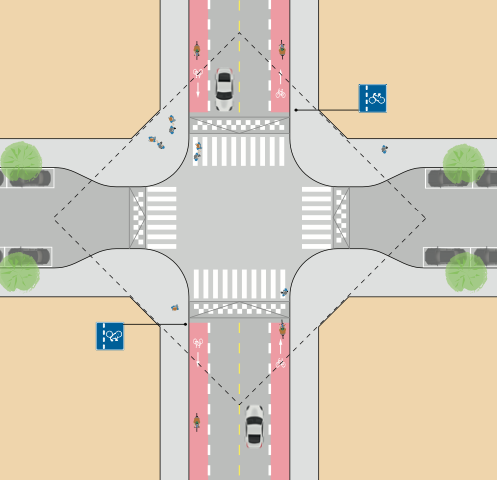
| Description | Diagram of a raised from a bird's-eye view showing connected cycle lanes and a narrowing of the street crossing the cycle lanes direction. |
|---|---|
| Author | Oslo Kommune, Bymiljøetaten (Oslo Municipality, Agency for City Environment) |
| Source | “Oslostandarden for sykkeltilrettelegging” (page 49) https://www.oslo.kommune.no/getfile.php/13255100-1675406859/Tjenester%20og%20tilbud/Gate%2C%20transport%20og%20parkering/Sykkel/Sykkelstrategier%20og%20dokumenter/Veiledere/Oslostandarden%20for%20sykkeltilrettelegging.pdf |
| Date | February 27th, 2017 |
| Permission | Public Domain |
File history
Click on a date/time to view the file as it appeared at that time.
| Date/Time | Thumbnail | Dimensions | User | Comment | |
|---|---|---|---|---|---|
| current | 19:56, 1 July 2022 | | 497 × 480 (63 KB) | BYM - Ola Juul Holm (talk | contribs) |
You cannot overwrite this file.
File usage
The following page uses this file: