File:Reading uni whiteknights campus.png
Jump to navigation
Jump to search


Size of this preview: 734 × 600 pixels. Other resolutions: 294 × 240 pixels | 587 × 480 pixels | 940 × 768 pixels | 1,253 × 1,024 pixels | 1,500 × 1,226 pixels.
Original file (1,500 × 1,226 pixels, file size: 752 KB, MIME type: image/png)
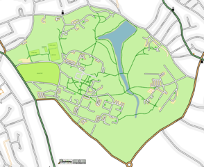
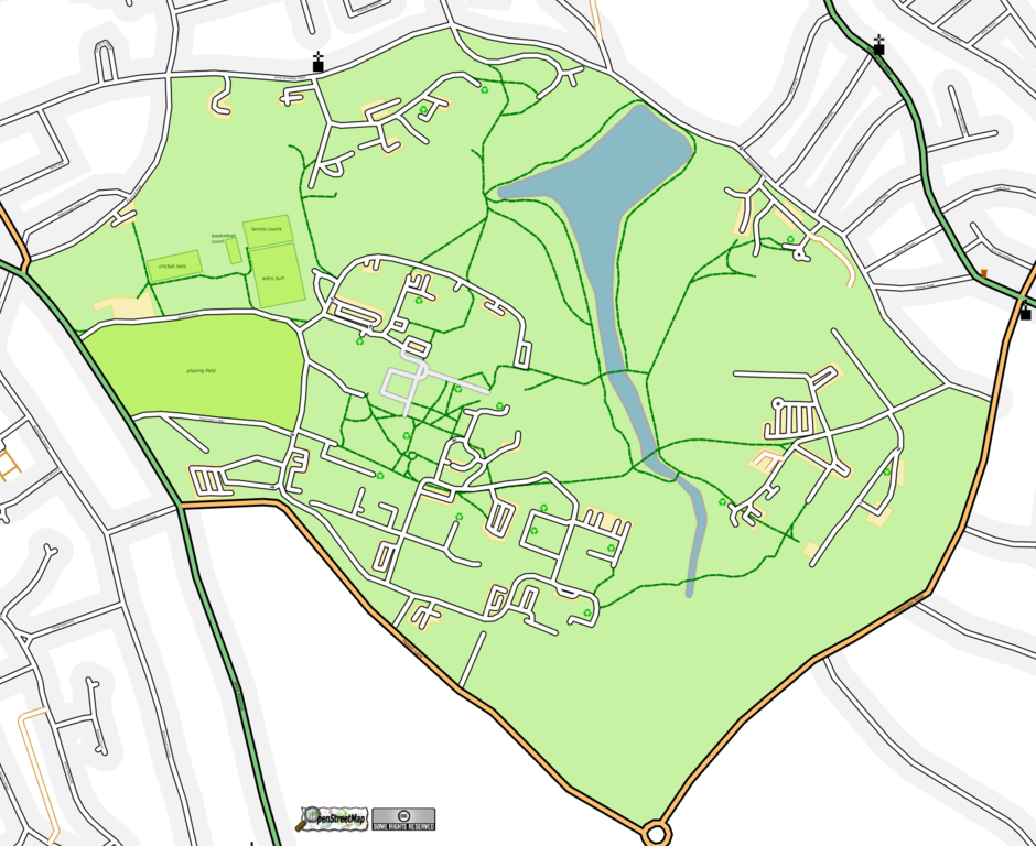
Map of Reading
This map and others like it, were created by OpenStreetmap contributors, and are licensed as Creative Commons CC-BY-SA 2.0 (https://creativecommons.org/licenses/by-sa/2.0/) (see OpenStreetMap licence).
Use {{mapof|PlaceName}} to add this template to your images.
This map and others like it, were created by OpenStreetmap contributors, and are licensed as Creative Commons CC-BY-SA 2.0 (https://creativecommons.org/licenses/by-sa/2.0/) (see OpenStreetMap licence).
Use {{mapof|PlaceName}} to add this template to your images.
Reading University's Whiteknights campus showing recycling points. This SVG was manually tweaked after it was generated to get the layering correct (e.g. bring the lake above the field, and the pedestrianised road above the road casing but beneath the road stroke, so it appears as a proper turnoff). I also moved recycling symbols around to make them both accurate and clear, and added labels to the pitches.
This is a Featured image, which means that it has been identified as one of the best examples of OpenStreetMap mapping, or that it provides a useful illustration of the OpenStreetMap project. If you know another image of similar quality, you can nominate it on Featured image proposals.
Front-page image on 23 Sep 2006
File history
Click on a date/time to view the file as it appeared at that time.
| Date/Time | Thumbnail | Dimensions | User | Comment | |
|---|---|---|---|---|---|
| current | 17:10, 21 September 2006 | | 1,500 × 1,226 (752 KB) | TomChance (talk | contribs) | Reading University's Whiteknights campus showing recycling points. |
You cannot overwrite this file.
File usage
The following 4 pages use this file: