File:Redlands.png
Jump to navigation
Jump to search

Size of this preview: 800 × 460 pixels. Other resolutions: 320 × 184 pixels | 640 × 368 pixels | 945 × 543 pixels.
Original file (945 × 543 pixels, file size: 218 KB, MIME type: image/png)
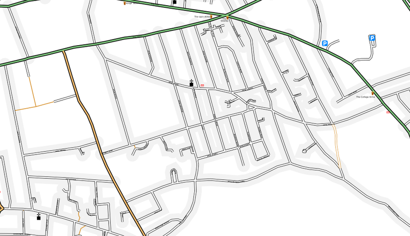
Most of the Redlands ward in Reading, UK, produced with a modified osmarender (added pubs, parking and post offices, manually tweaked some positioning).
![]()
Contains map data © OpenStreetMap contributors, made available under the terms of the Creative Commons Attribution-ShareAlike 2.0 (CC-BY-SA-2.0).
File history
Click on a date/time to view the file as it appeared at that time.
| Date/Time | Thumbnail | Dimensions | User | Comment | |
|---|---|---|---|---|---|
| current | 09:54, 30 August 2006 | | 945 × 543 (218 KB) | TomChance (talk | contribs) | Most of the Redlands ward in Reading, UK, produced with a modified osmarender (added pubs, parking and post offices, manually tweaked some positioning). |
You cannot overwrite this file.
File usage
There are no pages that use this file.