File:Riga-linux-16.png
Jump to navigation
Jump to search

Size of this preview: 583 × 599 pixels. Other resolutions: 233 × 240 pixels | 467 × 480 pixels | 778 × 800 pixels.
Original file (778 × 800 pixels, file size: 41 KB, MIME type: image/png)
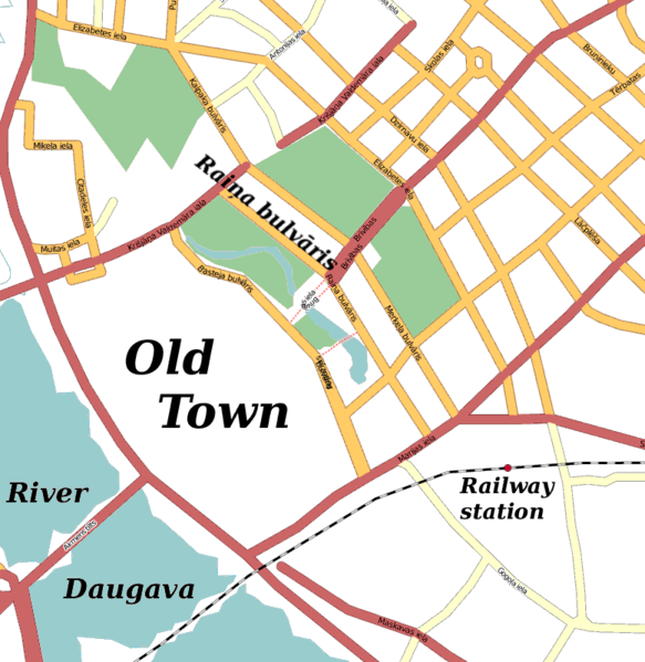
Map of downtown Riga, Latvia, indicating the street Raiņa bulvāris where the Linux Center is located. Based on the Mapnik rendering of OpenStreetMap.
![]()
Contains map data © OpenStreetMap contributors, made available under the terms of the Creative Commons Attribution-ShareAlike 2.0 (CC-BY-SA-2.0).
File history
Click on a date/time to view the file as it appeared at that time.
| Date/Time | Thumbnail | Dimensions | User | Comment | |
|---|---|---|---|---|---|
| current | 18:51, 4 May 2007 | | 778 × 800 (41 KB) | LA2 (talk | contribs) | Map of downtown Riga, Latvia, indicating the street Raiņa bulvāris where the Linux Center is located. Based on the Mapnik rendering of OpenStreetMap. |
You cannot overwrite this file.
File usage
The following page uses this file: