File:Rondebosch.png
Jump to navigation
Jump to search


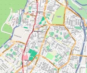
Size of this preview: 709 × 600 pixels. Other resolutions: 284 × 240 pixels | 567 × 480 pixels | 864 × 731 pixels.
Original file (864 × 731 pixels, file size: 512 KB, MIME type: image/png)
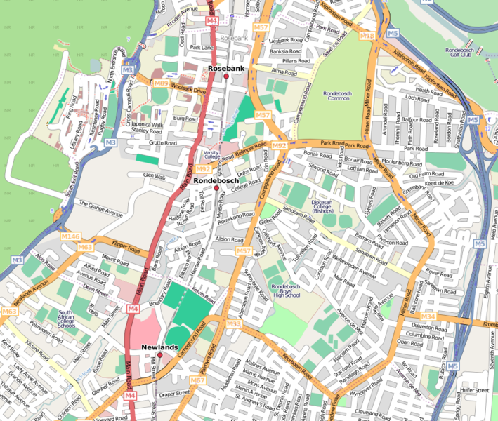
mapnik render of Rondebosch, Cape Town as at 2008-05-22
This is a Featured image, which means that it has been identified as one of the best examples of OpenStreetMap mapping, or that it provides a useful illustration of the OpenStreetMap project. If you know another image of similar quality, you can nominate it on Featured image proposals.
Front-page image on 08 Sep 2007
Licensing
![]()
![]()
![]()
This screenshot contains OpenStreetMap Carto rendering.
The OpenStreetMap Carto map style is made available under the Creative Commons CC-0 1.0 Universal Public Domain Dedication.
- Attribution to the map data:
![]()
Contains map data © OpenStreetMap contributors, made available under the terms of the Creative Commons Attribution-ShareAlike 2.0 (CC-BY-SA-2.0).
File history
Click on a date/time to view the file as it appeared at that time.
| Date/Time | Thumbnail | Dimensions | User | Comment | |
|---|---|---|---|---|---|
| current | 18:22, 22 May 2008 | | 864 × 731 (512 KB) | Htonl (talk | contribs) | update |
| 09:27, 27 April 2008 | 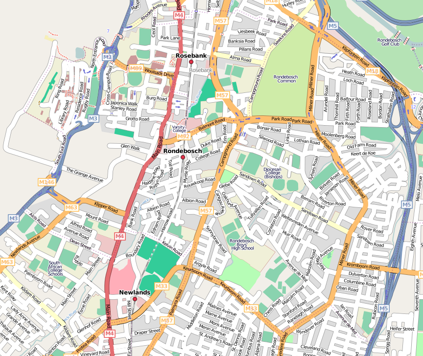 | 864 × 728 (507 KB) | Htonl (talk | contribs) | update | |
| 19:41, 21 October 2007 | 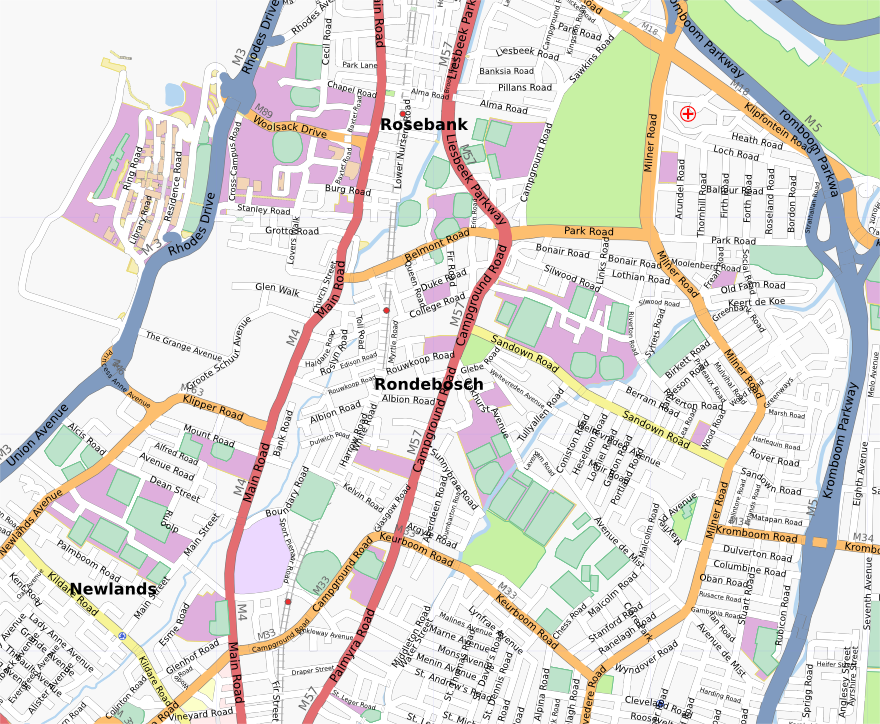 | 880 × 724 (678 KB) | Htonl (talk | contribs) | update | |
| 01:35, 14 September 2007 | 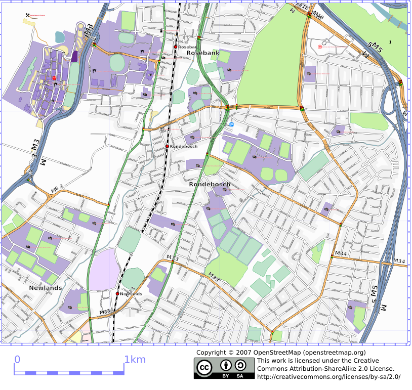 | 814 × 771 (604 KB) | Htonl (talk | contribs) | let's have a decent sized map | |
| 22:15, 13 September 2007 |  | 407 × 385 (215 KB) | Htonl (talk | contribs) | update | |
| 17:30, 18 August 2007 |  | 407 × 384 (203 KB) | Htonl (talk | contribs) | osmarender of Rondebosch, Cape Town as at 2007-08-18 |
You cannot overwrite this file.
File usage
The following 4 pages use this file: