File:Routes net.png
Original file (1,014 × 703 pixels, file size: 75 KB, MIME type: image/png)
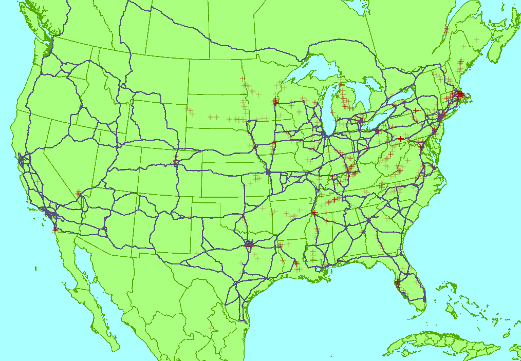
A visualisation of the routes used in aggregate for the 22/07/2009 routing (TIGER fixup/250 cities)- showing that there are many possibilities for shorter routes. If you pick two cities then there is no shorter way between them in OSM than to follow the blue routes indicated. Red crosses indicate duplicate motorway nodes, such as at county borders.
Licensing
![]()
Files without licences marked with this template are listed in Category:Media without a license or one of its subcategories. If the file is without a known open licence: ask its uploader to clarify situation or find a replacement and mark this file with {{Superseded by Commons}} and replace its uses.
If uploader was notified this month: use {{No licence|subcategory=uploader notified 2024, April}} - to put media into Category:Media without a license - uploader notified 2024, April and mark image as one where uploader was notified.
File history
Click on a date/time to view the file as it appeared at that time.
| Date/Time | Thumbnail | Dimensions | User | Comment | |
|---|---|---|---|---|---|
| current | 11:52, 19 August 2009 | | 1,014 × 703 (75 KB) | Matt (talk | contribs) | New version of routes network visualisation. This one shows duplicate nodes as red crosses instead of cities, as the cities are all now joined-up. |
| 13:51, 30 July 2009 |  | 1,014 × 703 (57 KB) | Gravitystorm (talk | contribs) | A visualisation of the routes used in aggregate for the 22/07/2009 routing - showing that there are many possibilities for shorter routes. |
You cannot overwrite this file.
File usage
The following page uses this file: