File:Rozc namest.jpg
Jump to navigation
Jump to search

Size of this preview: 337 × 599 pixels. Other resolutions: 135 × 240 pixels | 270 × 480 pixels | 432 × 768 pixels | 576 × 1,024 pixels | 1,152 × 2,048 pixels | 2,988 × 5,312 pixels.
Original file (2,988 × 5,312 pixels, file size: 4.72 MB, MIME type: image/jpeg)
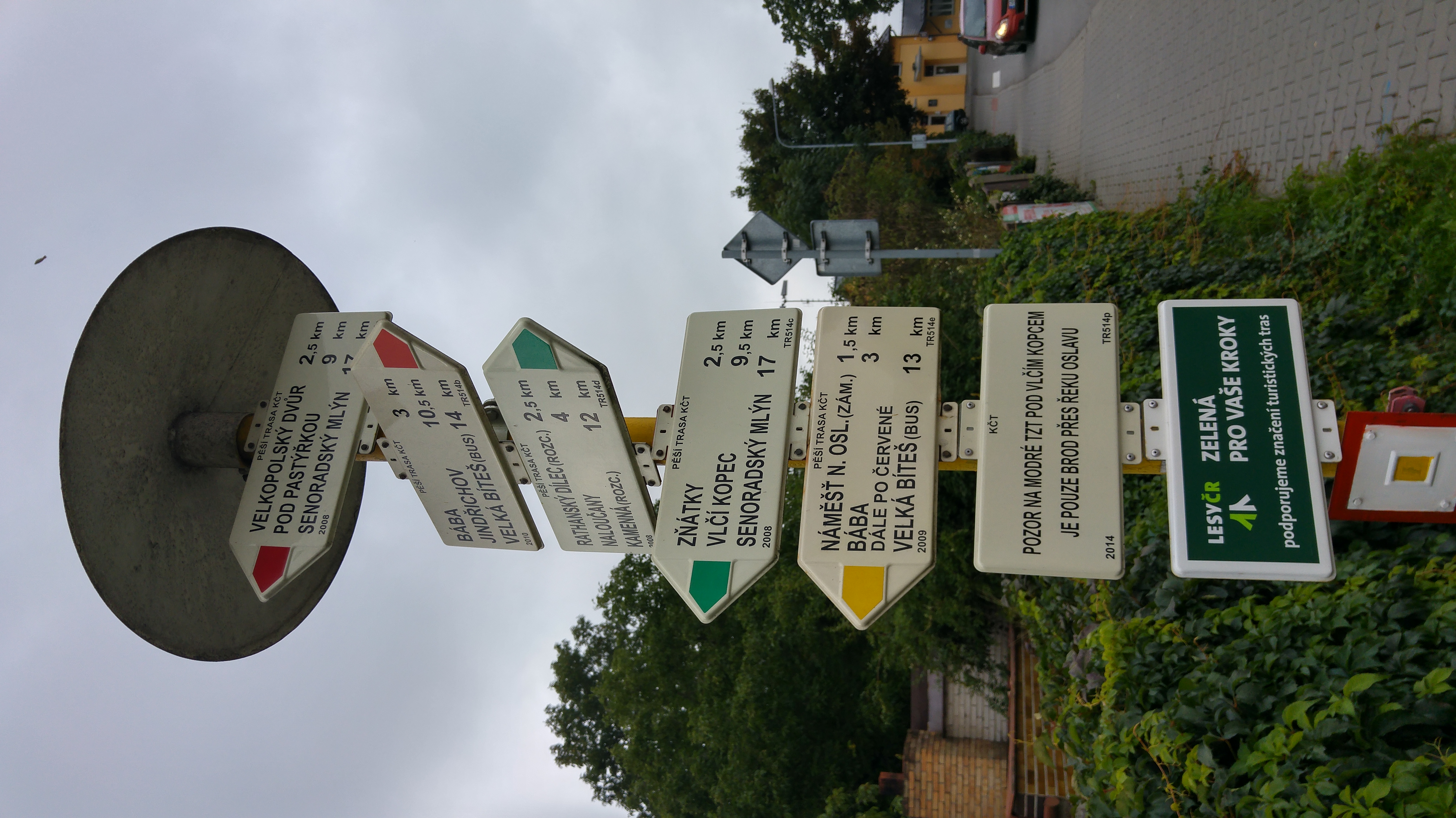
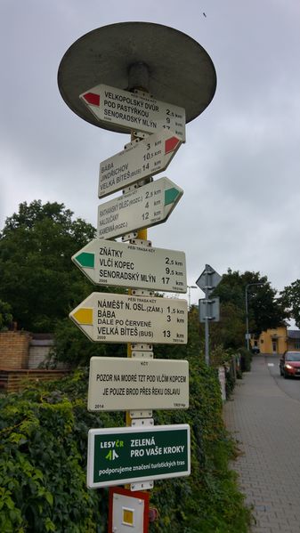
Snímek obsahuje všechny směrníky a jejich texty, informační tabulku i značku začátku žluté trasy.
- This media file was uploaded by author of the work and its copyright holder.
![]()
![]()
![]()
This work is licensed under the Creative Commons Attribution-ShareAlike 4.0 License.
Attribution: Vop
Attribution: Vop
File history
Click on a date/time to view the file as it appeared at that time.
| Date/Time | Thumbnail | Dimensions | User | Comment | |
|---|---|---|---|---|---|
| current | 17:33, 27 June 2016 | | 2,988 × 5,312 (4.72 MB) | Vop (talk | contribs) | Snímek obsahuje všechny směrníky a jejich texty, informační tabulku i značku začátku žluté trasy. |
You cannot overwrite this file.
File usage
The following page uses this file: