File:SIGPAC 2018 Catalunya.png
Jump to navigation
Jump to search


Size of this preview: 617 × 599 pixels. Other resolutions: 247 × 240 pixels | 494 × 480 pixels | 791 × 768 pixels | 1,054 × 1,024 pixels | 2,108 × 2,048 pixels | 5,050 × 4,906 pixels.
Original file (5,050 × 4,906 pixels, file size: 25.47 MB, MIME type: image/png)
Summary
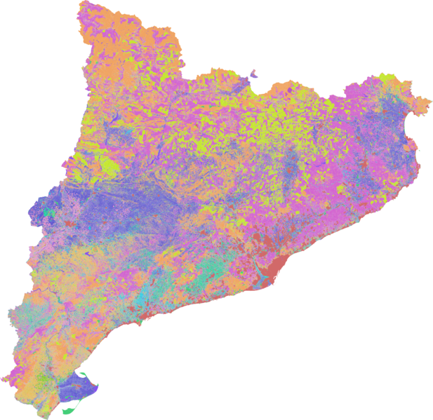
Landuse data in Catalonia according to SIGPAC 2018 landuse classification.
Data source: Government of Catalonia. Department of Agriculture, Livestock, Fisheries and Food.
Licensing

The copyright holder of this file allows anyone to use it for any purpose, provided that the copyright holder is properly attributed. Redistribution, derivative work, commercial use, and all other use is permitted.
If you are the uploader, please provide proper attribution including source and name of author.
If you are the uploader, please provide proper attribution including source and name of author.
File history
Click on a date/time to view the file as it appeared at that time.
| Date/Time | Thumbnail | Dimensions | User | Comment | |
|---|---|---|---|---|---|
| current | 15:10, 7 March 2019 | | 5,050 × 4,906 (25.47 MB) | Javirg (talk | contribs) | Landuse data in Catalonia according to SIGPAC 2018 landuse classification. Data source: Government of Catalonia. Department of Agriculture, Livestock, Fisheries and Food. |
You cannot overwrite this file.
File usage
The following page uses this file: