File:San Pablo RoadGuide Garmin 2011-12.png
Jump to navigation
Jump to search


Size of this preview: 800 × 589 pixels. Other resolutions: 320 × 235 pixels | 640 × 471 pixels | 878 × 646 pixels.
Original file (878 × 646 pixels, file size: 51 KB, MIME type: image/png)
Information
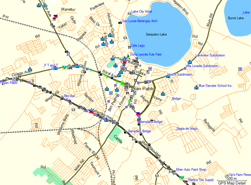
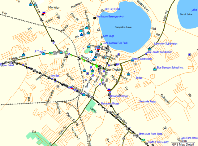
| Description | A Garmin MapSource screenshot of the RoadGuide.ph Garmin map centered on San Pablo, Laguna with the default style. |
|---|---|
| Author | Screenshot taken by seav |
| Source | RoadGuide.ph Garmin map (Contributors Map 2.04) |
| Date | 2011-12-26 |
| Permission | Fair use for camparison with File:San Pablo OSMPH Garmin 2011-12.png |
File history
Click on a date/time to view the file as it appeared at that time.
| Date/Time | Thumbnail | Dimensions | User | Comment | |
|---|---|---|---|---|---|
| current | 12:01, 6 March 2012 | | 878 × 646 (51 KB) | Seav (talk | contribs) | ==Information== {{Information |Description = A Garmin MapSource screenshot of the RoadGuide.ph Garmin map centered on San Pablo, Laguna with the default style. |Source = RoadGuide.ph Garmin map (Contributors Map 2.04) |Author = Screensh |
You cannot overwrite this file.
File usage
The following page uses this file: