File:Santa Ana, Manila Mapping Party before and after.png
Jump to navigation
Jump to search

Size of this preview: 500 × 600 pixels. Other resolutions: 200 × 240 pixels | 400 × 480 pixels | 1,000 × 1,200 pixels.
Original file (1,000 × 1,200 pixels, file size: 1,011 KB, MIME type: image/png)
Information
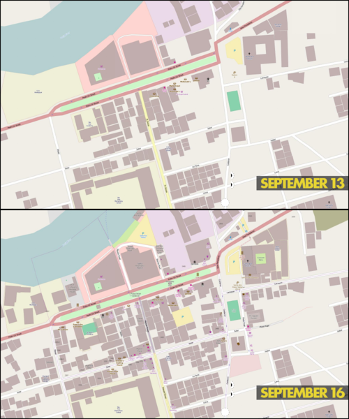
| Description | Mapnik rendering of central Santa Ana, Manila before (September 13) and after (September 16) the Santa Ana, Manila Mapping Party last September 13, 2014. |
|---|---|
| Author | © OpenStreetMap contributors; image by seav |
| Source | OSM (Mapnik layer) (permalink to map) |
| Date | 2014-09-25 |
Licensing
| Contains map data © OpenStreetMap contributors, made available under the terms of the Open Database License (ODbL).
The ODbL does not require any particular license for maps produced from ODbL data, produced maps may be subject also to other licences. |
File history
Click on a date/time to view the file as it appeared at that time.
| Date/Time | Thumbnail | Dimensions | User | Comment | |
|---|---|---|---|---|---|
| current | 23:24, 24 September 2014 | | 1,000 × 1,200 (1,011 KB) | Seav (talk | contribs) | ==Information== {{Information |Description = Mapnik rendering of central Santa Ana, Manila before (September 13) and after (September 16) the Santa Ana, Manila Mapping Party last September 13, 2014. |Source = OSM (Mapnik layer) ([http://... |
You cannot overwrite this file.
File usage
There are no pages that use this file.