File:Screenshot-FlightGear multiplayer map-1.png
Jump to navigation
Jump to search


Size of this preview: 800 × 573 pixels. Other resolutions: 320 × 229 pixels | 640 × 459 pixels | 1,024 × 734 pixels | 1,157 × 829 pixels.
Original file (1,157 × 829 pixels, file size: 458 KB, MIME type: image/png)
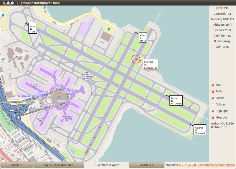
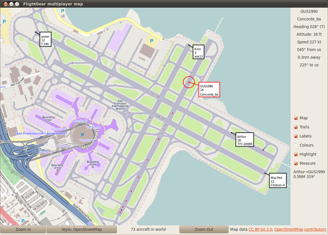
This is a Featured image, which means that it has been identified as one of the best examples of OpenStreetMap mapping, or that it provides a useful illustration of the OpenStreetMap project. If you know another image of similar quality, you can nominate it on Featured image proposals.
Front-page image for week 24 of 2012 (11–17 Jun.).
- Image descriptions
- English : FlightGear aircraft shown over OpenStreetMap's detail of KSFO airport.
- français : Avion de FlightGear affiché au dessus des détails, dans OpenStreetMap, de l'aéroport KSFO.
- italiano : Aereo del simulatore FlightGear visualizzato sopra un dettaglio OpenStreetMap dell'areoporto KSFO.
- 中文(简体) : FlightGear 中的飞机,详详细细的显示在开放街图中的旧金山国际机场。
- 中文(繁體) : FlightGear 中的飛機,詳詳細細的顯示在開放街圖中的舊金山國際機場。
File history
Click on a date/time to view the file as it appeared at that time.
| Date/Time | Thumbnail | Dimensions | User | Comment | |
|---|---|---|---|---|---|
| current | 12:34, 11 June 2012 | | 1,157 × 829 (458 KB) | Ojw (talk | contribs) |
You cannot overwrite this file.