File:Señal vial de carril compartido con ciclistas y automoviles (pictograma).jpg
From OpenStreetMap Wiki
Jump to navigation
Jump to search
Size of this preview: 450 × 600 pixels. Other resolutions: 180 × 240 pixels | 360 × 480 pixels | 576 × 768 pixels | 768 × 1,024 pixels | 2,448 × 3,264 pixels.
Original file (2,448 × 3,264 pixels, file size: 1,020 KB, MIME type: image/jpeg)
This file and its description are from Wikimedia Commons.
Summary
DescriptionSeñal vial de carril compartido con ciclistas y automoviles (pictograma).jpg |
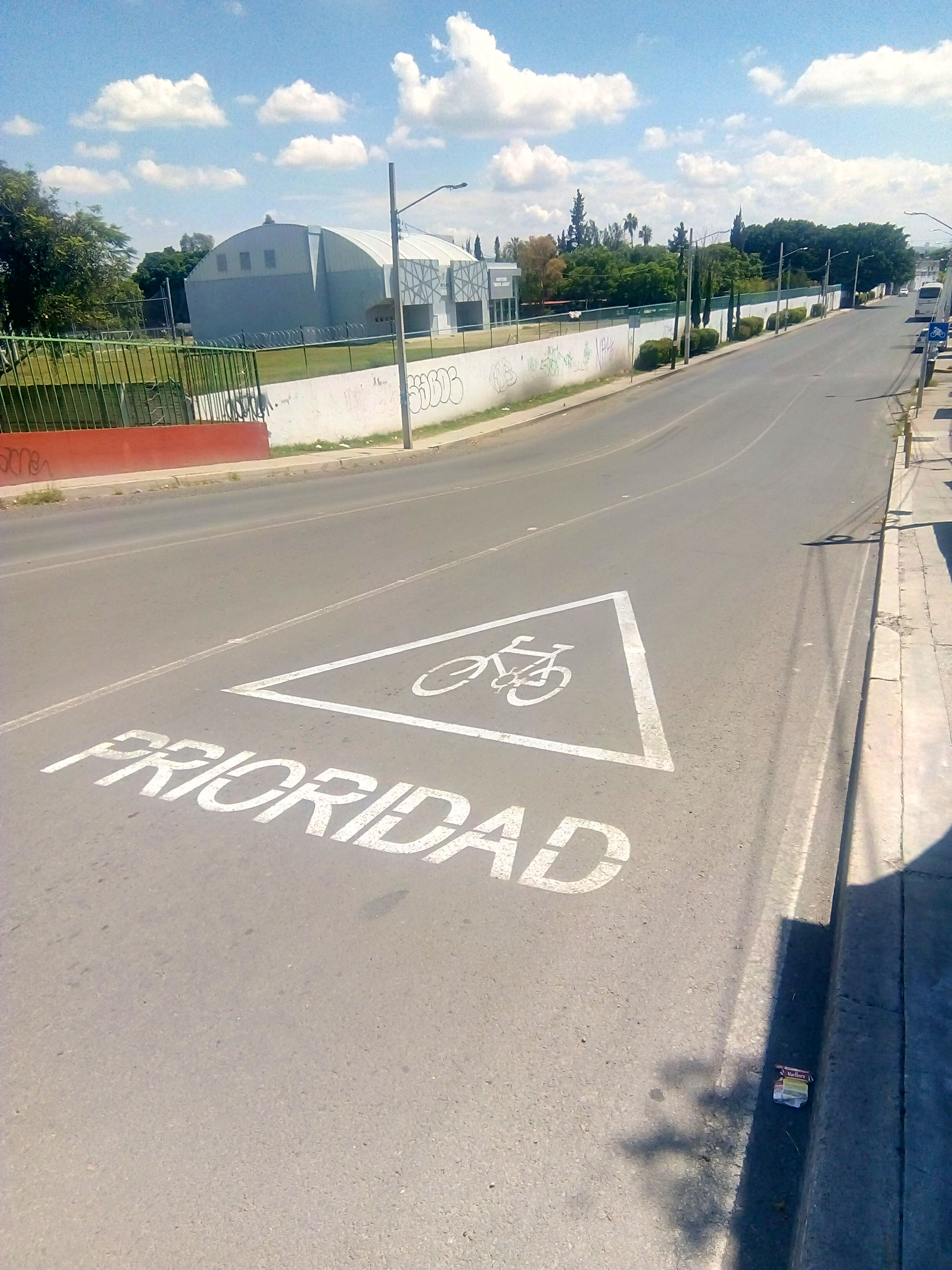
English: Una señal de tráfico en el pavimento (pictograma) indicando que un carril es compartido con ciclistas y automovilistas.
Lugar del señalamiento: bajando puente de los Alcanfores, dirección sur, Santiago de Querétaro, Querétaro, México. |
Date | |
Source | Own work |
Author | JeSe-MX |
Camera location | 20° 36′ 01.3″ N, 100° 24′ 23.63″ W | View this and other nearby images on: OpenStreetMap | 20.600361; -100.406563 |
---|
Licensing
I, the copyright holder of this work, hereby publish it under the following license:
This file is licensed under the Creative Commons Attribution-Share Alike 4.0 International license.
- You are free:
- to share – to copy, distribute and transmit the work
- to remix – to adapt the work
- Under the following conditions:
- attribution – You must give appropriate credit, provide a link to the license, and indicate if changes were made. You may do so in any reasonable manner, but not in any way that suggests the licensor endorses you or your use.
- share alike – If you remix, transform, or build upon the material, you must distribute your contributions under the same or compatible license as the original.
Items portrayed in this file
depicts
image/jpeg
de61ba98f7f9e74e19f531d4535078efc1c9f611
1,044,652 byte
3,264 pixel
2,448 pixel
24 September 2022
20°36'1.300"N, 100°24'23.627"W
0.001404 second
3.5 millimetre
112
File history
Click on a date/time to view the file as it appeared at that time.
Date/Time | Thumbnail | Dimensions | User | Comment | |
---|---|---|---|---|---|
current | 14:56, 28 September 2022 | 2,448 × 3,264 (1,020 KB) | wikimediacommons>JeSe-MX | Uploaded own work with UploadWizard |
File usage
The following page uses this file:
Metadata
This file contains additional information, probably added from the digital camera or scanner used to create or digitize it.
If the file has been modified from its original state, some details may not fully reflect the modified file.
Camera manufacturer | HMD Global |
---|---|
Camera model | TA-1028 |
Author | JeSe-MX |
Copyright holder |
|
Exposure time | 351/250,000 sec (0.001404) |
F Number | f/2 |
ISO speed rating | 112 |
Date and time of data generation | 14:41, 24 September 2022 |
Lens focal length | 3.5 mm |
Latitude | 20° 36′ 1.3″ N |
Longitude | 100° 24′ 23.63″ W |
Altitude | 1,813 meters above sea level |
Image title | Una señal de tráfico en el pavimento (pictograma) indicando que un carril es compartido con ciclistas y automovilistas. Lugar del señalamiento: bajando puente de los Alcanfores, dirección sur, Santiago de Querétaro, Querétaro, México. |
Width | 2,448 px |
Height | 3,264 px |
Bits per component |
|
Pixel composition | RGB |
Orientation | Normal |
Number of components | 3 |
Horizontal resolution | 72 dpi |
Vertical resolution | 72 dpi |
Software used | Adobe Photoshop CS6 (Windows) |
File change date and time | 14:41, 24 September 2022 |
Y and C positioning | Co-sited |
Exposure Program | Not defined |
Exif version | 2.2 |
Date and time of digitizing | 14:41, 24 September 2022 |
Meaning of each component |
|
APEX shutter speed | 9.471675 |
APEX aperture | 2 |
APEX exposure bias | 0 |
Metering mode | Center weighted average |
Light source | Other light source |
Flash | Flash did not fire |
DateTime subseconds | 53 |
DateTimeOriginal subseconds | 53 |
DateTimeDigitized subseconds | 53 |
Supported Flashpix version | 1 |
Color space | sRGB |
Exposure mode | Auto exposure |
White balance | Auto white balance |
Digital zoom ratio | 1 |
Scene capture type | Standard |
GPS time (atomic clock) | 19:41 |
Reference for direction of image | True direction |
Direction of image | 192 |
GPS date | 24 September 2022 |
GPS tag version | 0.0.2.2 |
IIM version | 52,704 |
Short title | Señal en Pavimento de Carril compartido con bicicletas |
City shown | Santiago de Querétaro |
Sublocation of city shown | Los Alcanfores |
Province or state shown | Querétaro |
Code for country shown | MEX |
Country shown | México |
Geodetic survey data used | WGS-84 |
Date metadata was last modified | 04:50, 28 September 2022 |
Unique ID of original document | CFB8BA2FEEB6F75748FD980F414297FA |
Online copyright statement | https://creativecommons.org/licenses/by-sa/4.0/ |