File:Se peak district.png
Jump to navigation
Jump to search

Size of this preview: 470 × 600 pixels. Other resolutions: 188 × 240 pixels | 584 × 745 pixels.
Original file (584 × 745 pixels, file size: 277 KB, MIME type: image/png)
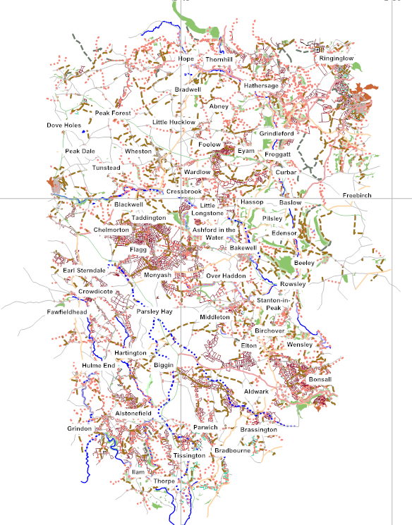
Map of SE Peak District UK highlighting field boundaries. Feb 2013
File history
Click on a date/time to view the file as it appeared at that time.
| Date/Time | Thumbnail | Dimensions | User | Comment | |
|---|---|---|---|---|---|
| current | 21:34, 21 February 2013 | | 584 × 745 (277 KB) | Dud1 (talk | contribs) | Map of SE Peak District UK highlighting field boundaries. Feb 2013 |
You cannot overwrite this file.
File usage
There are no pages that use this file.