File:Seyne-la-station-du-grand-puy-plan-des-pistes-minimaliste-avec-qgis.png
Jump to navigation
Jump to search

Size of this preview: 800 × 566 pixels. Other resolutions: 320 × 226 pixels | 640 × 453 pixels | 1,024 × 724 pixels | 1,280 × 905 pixels | 2,560 × 1,810 pixels | 3,507 × 2,480 pixels.
Original file (3,507 × 2,480 pixels, file size: 499 KB, MIME type: image/png)
Summary
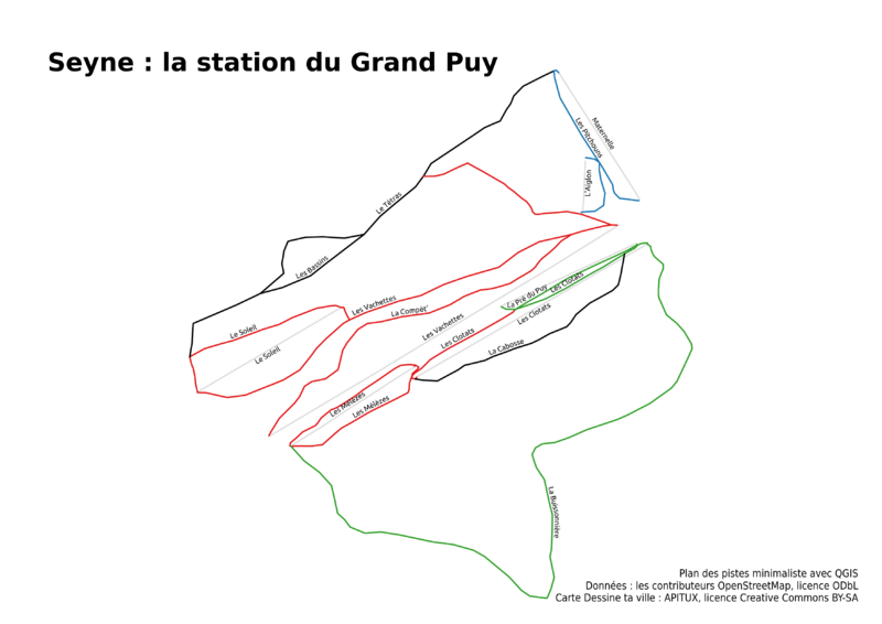
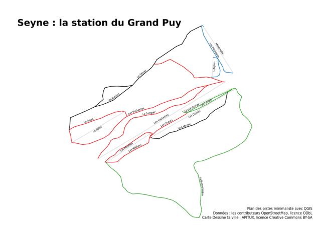
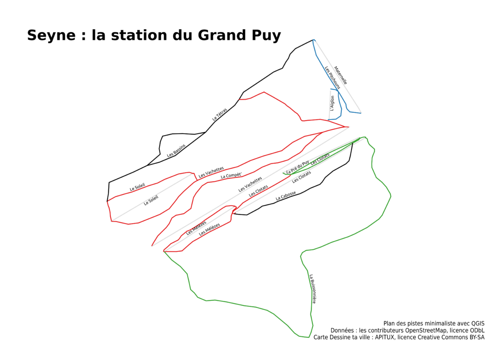
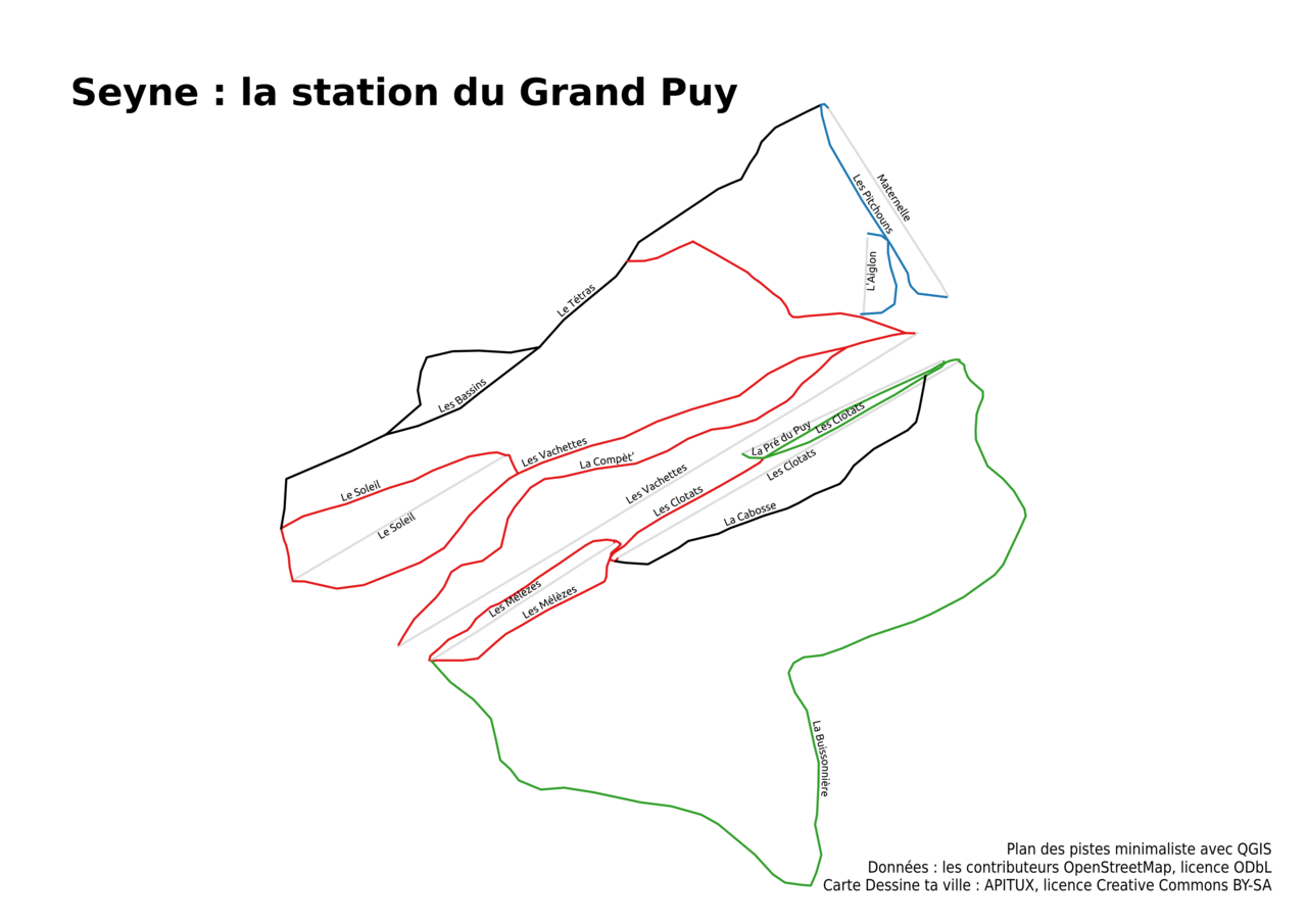
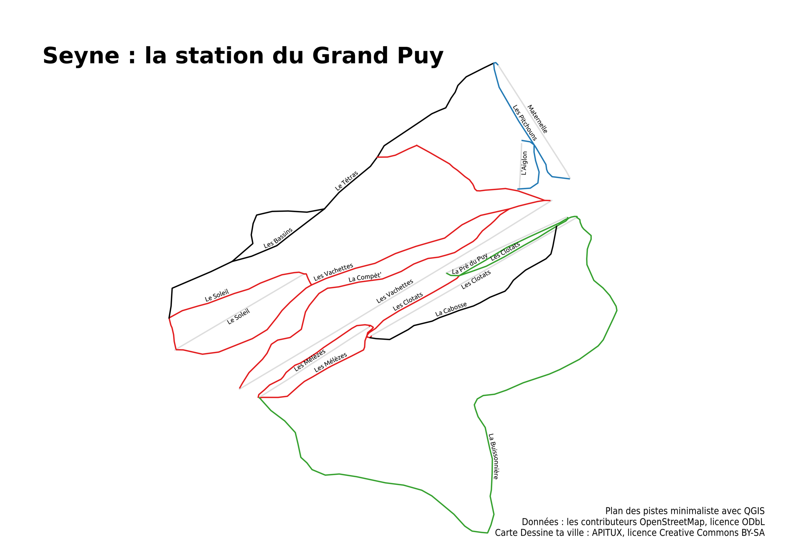
Seyne : la station du Grand Puy
Plan des pistes minimaliste avec QGIS
Données : les contributeurs OpenStreetMap, licence ODbL
Carte Dessine ta ville : APITUX, licence Creative Commons BY-SA
Licensing
![]()
![]()
![]()
This work is licensed under the Creative Commons Attribution-ShareAlike 4.0 License.
Attribution not specified as a parameter! THIS LICENSE ALWAYS REQUIRES ATTRIBUTION! Use {{CC-BY-SA-4.0|Attribution, typically name of author}} See Template:CC-BY-SA-4.0 for full description this template should be used.
Attribution not specified as a parameter! THIS LICENSE ALWAYS REQUIRES ATTRIBUTION! Use {{CC-BY-SA-4.0|Attribution, typically name of author}} See Template:CC-BY-SA-4.0 for full description this template should be used.
File history
Click on a date/time to view the file as it appeared at that time.
| Date/Time | Thumbnail | Dimensions | User | Comment | |
|---|---|---|---|---|---|
| current | 08:55, 2 May 2018 | | 3,507 × 2,480 (499 KB) | Apitux (talk | contribs) | Correction de la localisation |
| 17:13, 1 May 2018 | 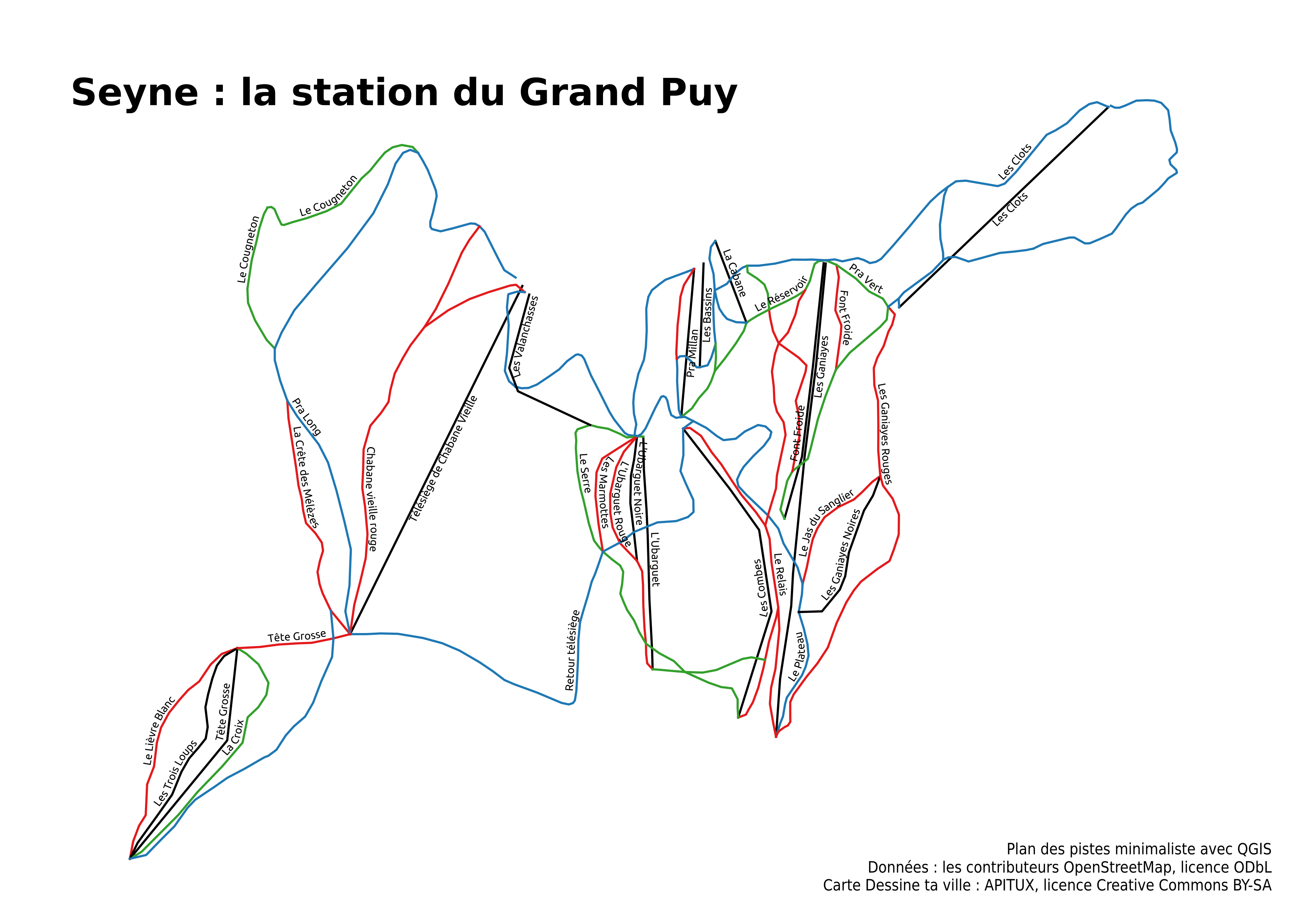 | 3,507 × 2,480 (765 KB) | Apitux (talk | contribs) | Seyne : la station du Grand Puy Plan des pistes minimaliste avec QGIS Données : les contributeurs OpenStreetMap, licence ODbL Carte Dessine ta ville : APITUX, licence Creative Commons BY-SA |
You cannot overwrite this file.
File usage
The following page uses this file: