File:Speed limit Germany.png
Jump to navigation
Jump to search


Size of this preview: 800 × 343 pixels. Other resolutions: 320 × 137 pixels | 640 × 274 pixels | 1,141 × 489 pixels.
Original file (1,141 × 489 pixels, file size: 843 KB, MIME type: image/png)
Summary
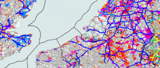
Speed limit km/h overlay map using ITO Map showing parts of Germany and The Netherlands. The speed limit mph map shows speed limits in miles per hour using a comparable colour scheme.
- Green: <40 km/h
- Orange:50 km/h
- Red:60/70 km/h
- Violet:80/90 km/h
- Light blue:100 km/h
- Dark blue:110/120 km/h
- Magenta=130 km/h
- Yellow:no numeric limit)
Licensing
![]()
![]()
![]()
This work is licensed under the Creative Commons Attribution-ShareAlike 2.0 License.
Attribution not specified as a parameter! THIS LICENSE ALWAYS REQUIRES ATTRIBUTION! Use {{CC-BY-SA-2.0|Attribution, typically name of author}} See Template:CC-BY-SA-2.0 for full description how this template should be used.
Note, there is
There is also
Attribution not specified as a parameter! THIS LICENSE ALWAYS REQUIRES ATTRIBUTION! Use {{CC-BY-SA-2.0|Attribution, typically name of author}} See Template:CC-BY-SA-2.0 for full description how this template should be used.
Note, there is
{{CC-BY-SA-2.0 OpenStreetMap}} for files based on old OSM map data, before the license change made on 2012-09-12.There is also
{{OSM Carto screenshot||old_license}} for files based on old OSM map data, before the license change made on 2012-09-12, created using OSM Carto map style.
File history
Click on a date/time to view the file as it appeared at that time.
| Date/Time | Thumbnail | Dimensions | User | Comment | |
|---|---|---|---|---|---|
| current | 08:02, 19 August 2011 | | 1,141 × 489 (843 KB) | PeterIto (talk | contribs) | |
| 05:59, 20 May 2011 | 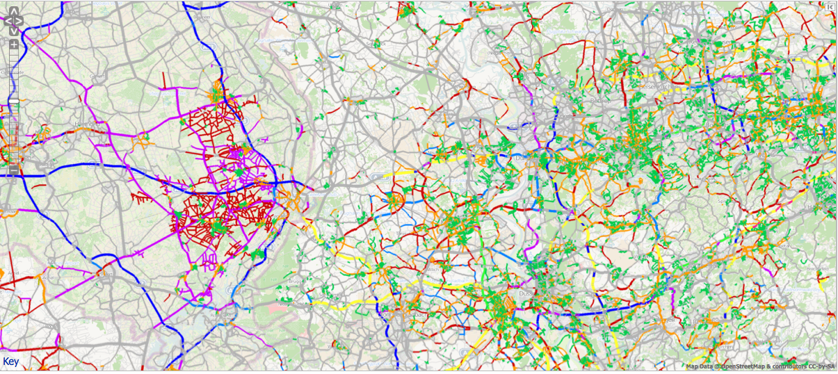 | 1,205 × 538 (1.62 MB) | PeterIto (talk | contribs) | [http://www.itoworld.com/product/data/ito_map/editor?view=35 Speed limit km/h overlay map] using ITO Map showing parts of Germany and The Netherlands (green =0-39km/h, orange=50, red=60/70, violet=80/90, light blue=100, dark blue=110/120, magenta=130, |
You cannot overwrite this file.
File usage
The following 8 pages use this file: