File:Susq-sp-guide.png
Jump to navigation
Jump to search

Size of this preview: 800 × 518 pixels. Other resolutions: 320 × 207 pixels | 640 × 415 pixels | 1,076 × 697 pixels.
Original file (1,076 × 697 pixels, file size: 227 KB, MIME type: image/png)
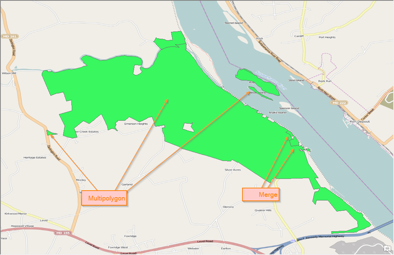
An example guide to show how parts of the land would be combined.
File history
Click on a date/time to view the file as it appeared at that time.
| Date/Time | Thumbnail | Dimensions | User | Comment | |
|---|---|---|---|---|---|
| current | 17:31, 18 April 2014 | | 1,076 × 697 (227 KB) | ElliottPlack (talk | contribs) | An example guide to show how parts of the land would be combined. |
You cannot overwrite this file.
File usage
The following 2 pages use this file: