File:Szczecin-gis-footprints.png
Szczecin-gis-footprints.png (705 × 599 pixels, file size: 151 KB, MIME type: image/png)
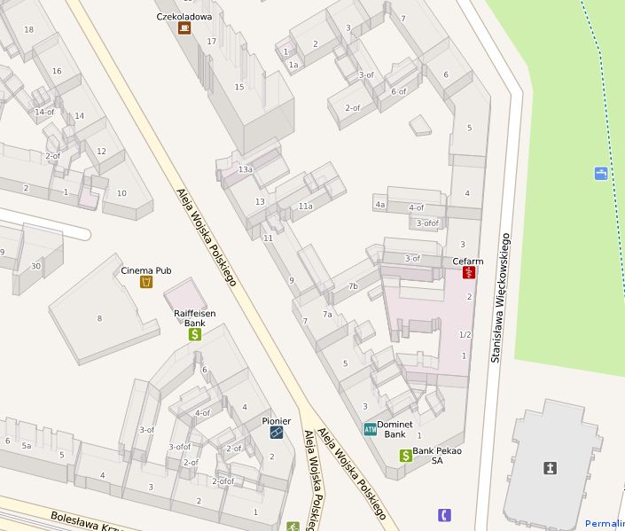
Building outlines, heights and addresses in Szczecin are being uploaded into OpenStreetMap. The tracing is done 75% automatically, from the buildings layer courtesy of the city's cadastre web service. The mapsurfer.net rendering of OpenStreetMap is shown with isometric buildings view.
Rendering is copyright MapSurfer.net.
There are hundreds of thousands of buildings, this is a random place in the city. There may be a more interesting places to take a screenshot of, please replace this image if you take a better shot.
File history
Click on a date/time to view the file as it appeared at that time.
| Date/Time | Thumbnail | Dimensions | User | Comment | |
|---|---|---|---|---|---|
| current | 01:20, 11 May 2010 | | 705 × 599 (151 KB) | Balrog (talk | contribs) | Building outlines, heights and addresses in [WikiProject_Poland/Szczecin|Szczecin] are being uploaded into OpenStreetMap. The tracing is done 75% automatically, from the buildings layer courtesy of the city's cadastre web service. The mapsurfer.net rend |
You cannot overwrite this file.
File usage
There are no pages that use this file.