File:Tactile paving ja.jpg
Jump to navigation
Jump to search

No higher resolution available.
Tactile_paving_ja.jpg (225 × 300 pixels, file size: 25 KB, MIME type: image/jpeg)
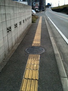
Tactile paving. Line tile means go and dot tile means stop.
File history
Click on a date/time to view the file as it appeared at that time.
| Date/Time | Thumbnail | Dimensions | User | Comment | |
|---|---|---|---|---|---|
| current | 03:53, 29 January 2010 | | 225 × 300 (25 KB) | Higa4 (talk | contribs) | Tactile paving. Line tile means go and dot tile means stop. |
You cannot overwrite this file.
File usage
The following 9 pages use this file: