File:Tendring Postcodes.jpeg
Jump to navigation
Jump to search
Size of this preview: 800 × 566 pixels. Other resolutions: 320 × 226 pixels | 640 × 453 pixels | 1,024 × 724 pixels | 1,280 × 905 pixels | 2,560 × 1,810 pixels | 3,507 × 2,480 pixels.
Original file (3,507 × 2,480 pixels, file size: 1.11 MB, MIME type: image/jpeg)
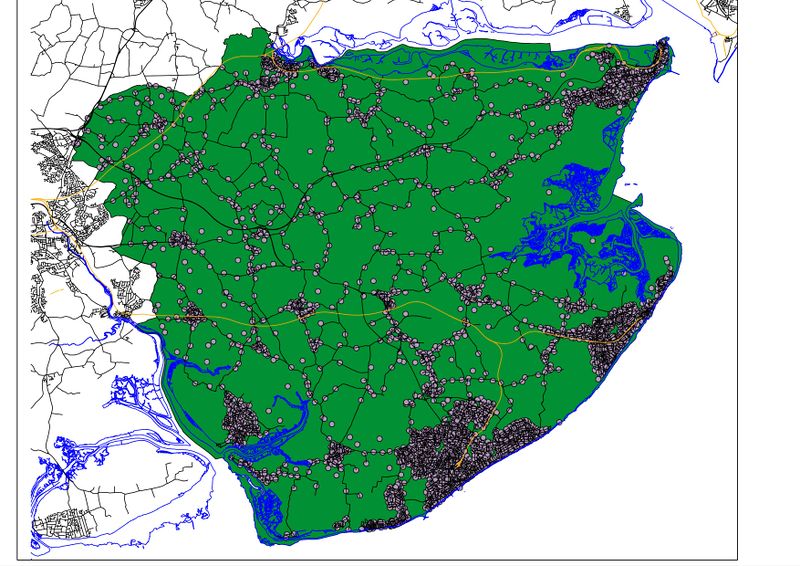
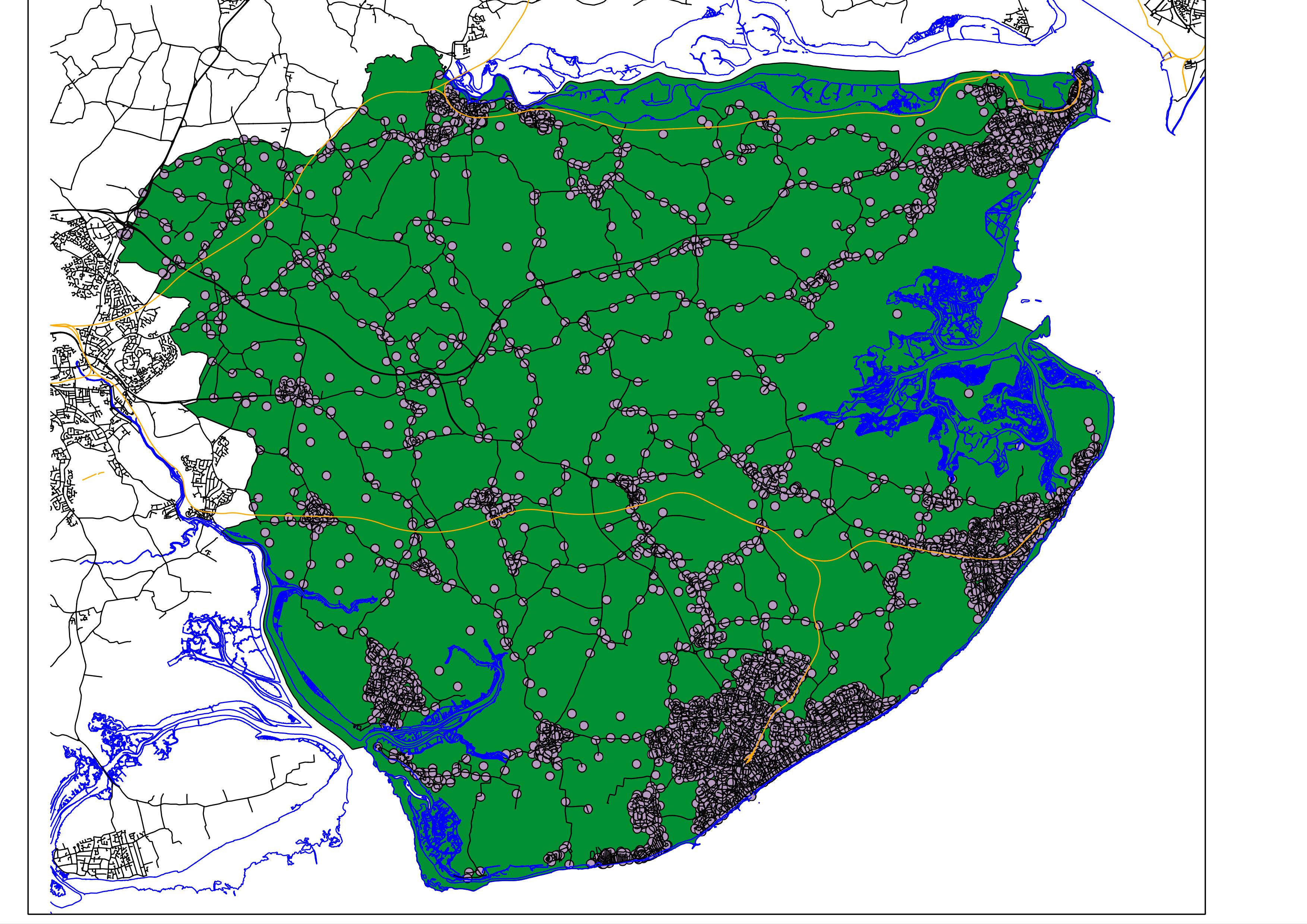
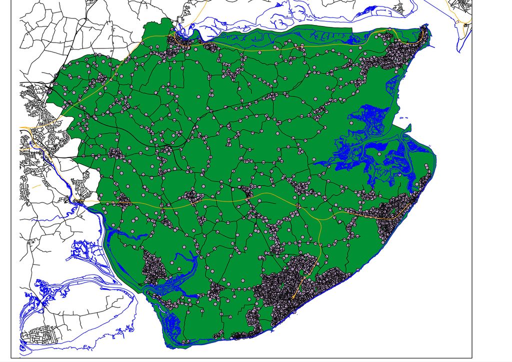
Example image using OS OpenData in QGIS. Codepoint Open data has been filtered to only contain Tendring District postcodes. BoundaryLine has been filtered to only include the Tendring district (green background). VectorLine has been used to add mean high and low water lines (blue), roads (black) and railway lines (orange).
File history
Click on a date/time to view the file as it appeared at that time.
| Date/Time | Thumbnail | Dimensions | User | Comment | |
|---|---|---|---|---|---|
| current | 09:12, 24 September 2010 | | 3,507 × 2,480 (1.11 MB) | EdLoach (talk | contribs) | Example image using OS OpenData in QGIS. Codepoint Open data has been filtered to only contain Tendring District postcodes. BoundaryLine has been filtered to only include the Tendring district (green background). VectorLine has been used to add mean high |
You cannot overwrite this file.
File usage
The following 2 pages use this file: