File:Topomaps coverage.png
Jump to navigation
Jump to search
Size of this preview: 574 × 599 pixels. Other resolutions: 230 × 240 pixels | 636 × 664 pixels.
Original file (636 × 664 pixels, file size: 80 KB, MIME type: image/png)
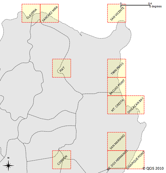
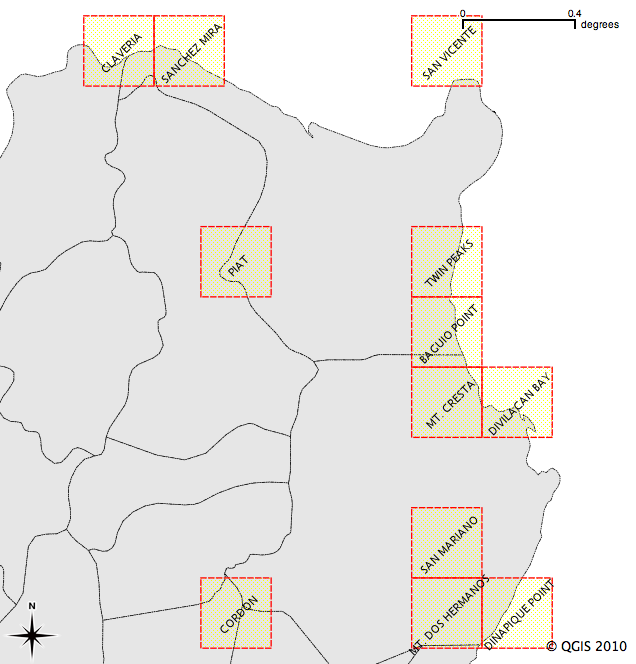
Extent of non-georefrenced 1:50,000 topomaps in Northern Luzon
File history
Click on a date/time to view the file as it appeared at that time.
| Date/Time | Thumbnail | Dimensions | User | Comment | |
|---|---|---|---|---|---|
| current | 08:06, 19 October 2010 | | 636 × 664 (80 KB) | Maning (talk | contribs) | Extent of non-georefrenced 1:50,000 topomaps in Northern Luzon |
You cannot overwrite this file.
File usage
The following page uses this file: