File:Townhome5.jpg
Jump to navigation
Jump to search

Size of this preview: 800 × 500 pixels. Other resolutions: 320 × 200 pixels | 640 × 400 pixels | 1,024 × 640 pixels | 1,280 × 800 pixels.
Original file (1,280 × 800 pixels, file size: 272 KB, MIME type: image/jpeg)
Summary
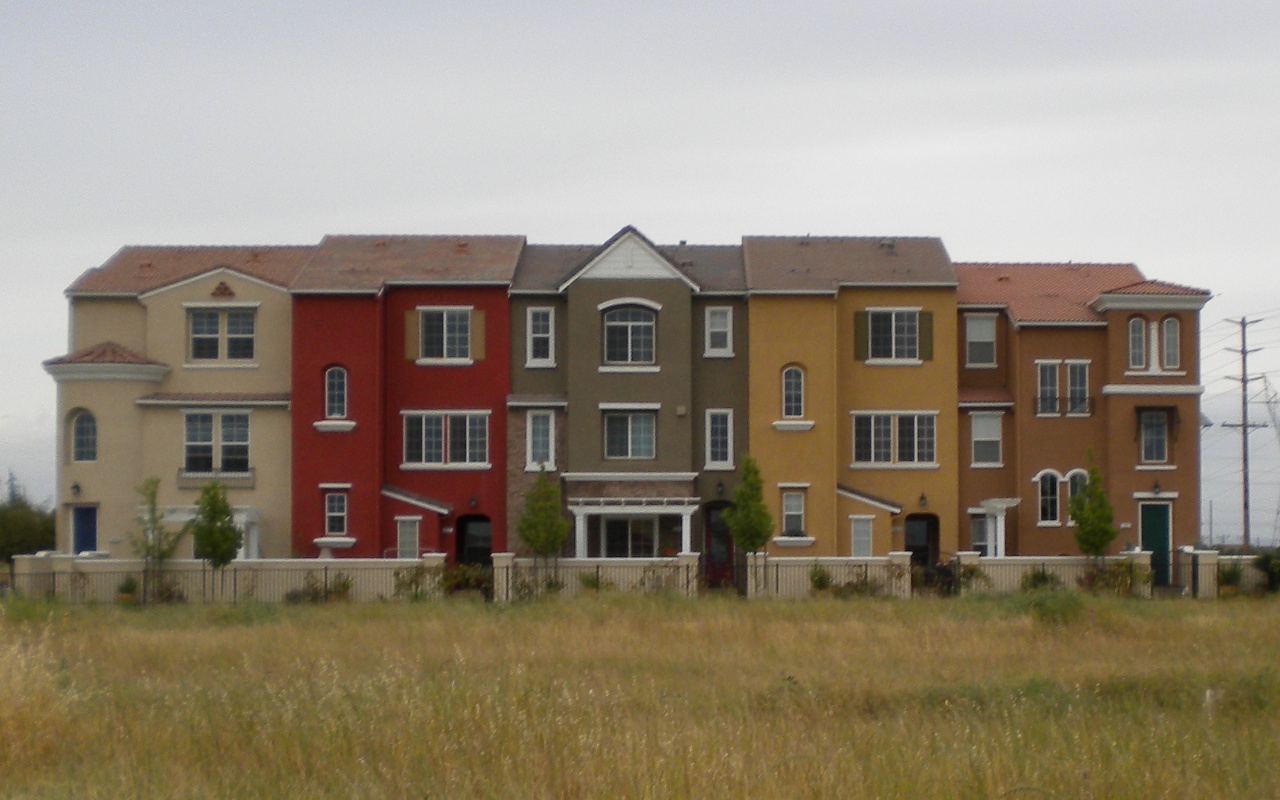
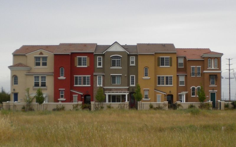
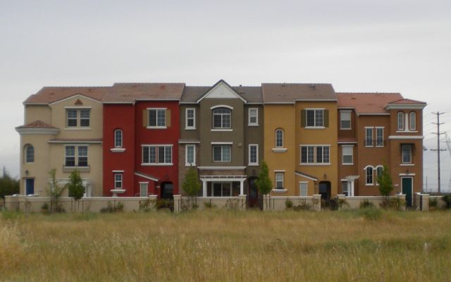
A "row of linked residential houses". In this case, each house has its own lot and its own roof, but the side walls are conjoined. I tagged each house separately as building=terrace. OSM way 103384432 in the middle.
Licensing
![]()
This file has been released into the public domain by the copyright holder, its copyright has expired, or it is ineligible for copyright. This applies worldwide.
Please, please use more specific template such as {{PD-self}} / {{PD-creator}} / {{PD-shape}} / {{PD-USGov}} / {{PD-old}} / {{PD-RU-exempt}} ... This template is not making clear why this work is in the public domain.
Please, please use more specific template such as {{PD-self}} / {{PD-creator}} / {{PD-shape}} / {{PD-USGov}} / {{PD-old}} / {{PD-RU-exempt}} ... This template is not making clear why this work is in the public domain.
File history
Click on a date/time to view the file as it appeared at that time.
| Date/Time | Thumbnail | Dimensions | User | Comment | |
|---|---|---|---|---|---|
| current | 23:10, 8 May 2011 | | 1,280 × 800 (272 KB) | T99 (talk | contribs) | A "row of linked residential houses". In this case, each house has its own lot and its own roof, but the side walls are conjoined. I tagged each house separately as {{tag|building|terrace}}. OSM way [http://www.openstreetmap.org/browse/node/1173790458 117 |
You cannot overwrite this file.
File usage
The following 2 pages use this file: