File:Trunk Continuity.png
Jump to navigation
Jump to search


Size of this preview: 586 × 600 pixels. Other resolutions: 234 × 240 pixels | 469 × 480 pixels | 719 × 736 pixels.
Original file (719 × 736 pixels, file size: 257 KB, MIME type: image/png)
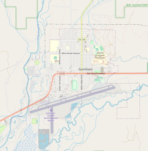
Trunk road (US 50) maintaining its tagging as it passes through a town, due to the high importance of the road. Maxspeed, lanes, and other descriptive tags are used to indicate the change in road features inside the town.
Licensing
![]()
![]()
This screenshot contains OpenStreetMap Carto rendering.
The OpenStreetMap Carto map style is made available under the Creative Commons CC-0 1.0 Universal Public Domain Dedication.
- Attribution to the map data:
| Contains map data © OpenStreetMap contributors, made available under the terms of the Open Database License (ODbL).
The ODbL does not require any particular license for maps produced from ODbL data, produced maps may be subject also to other licences. |
File history
Click on a date/time to view the file as it appeared at that time.
| Date/Time | Thumbnail | Dimensions | User | Comment | |
|---|---|---|---|---|---|
| current | 01:15, 24 October 2021 | | 719 × 736 (257 KB) | Phidauex (talk | contribs) |
You cannot overwrite this file.
File usage
The following 2 pages use this file: