File:Typhoon Haiyan mapping changeset bounding boxes viz by Pascal Neis.png
Jump to navigation
Jump to search
Size of this preview: 800 × 575 pixels. Other resolutions: 320 × 230 pixels | 640 × 460 pixels | 1,024 × 736 pixels | 1,280 × 921 pixels | 2,236 × 1,608 pixels.
Original file (2,236 × 1,608 pixels, file size: 1.59 MB, MIME type: image/png)
Summary
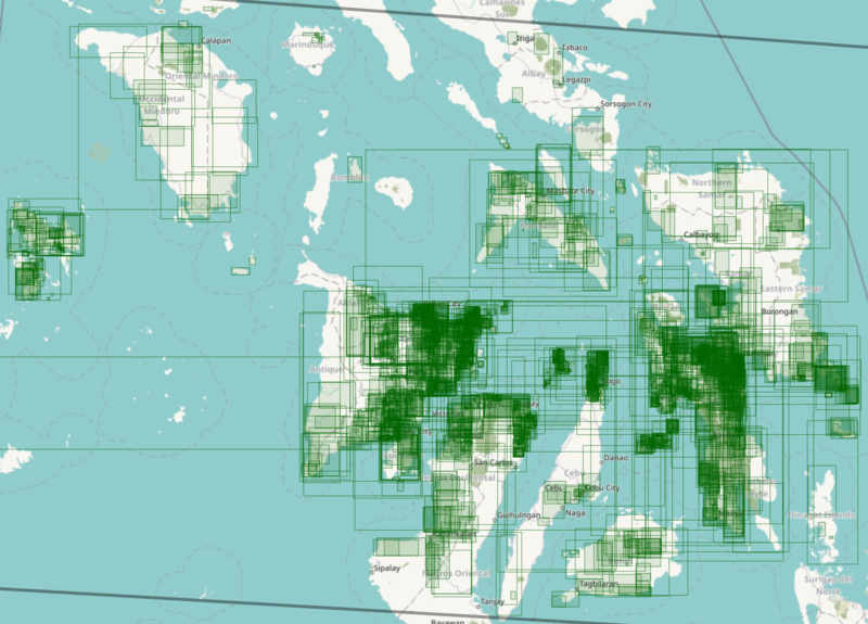
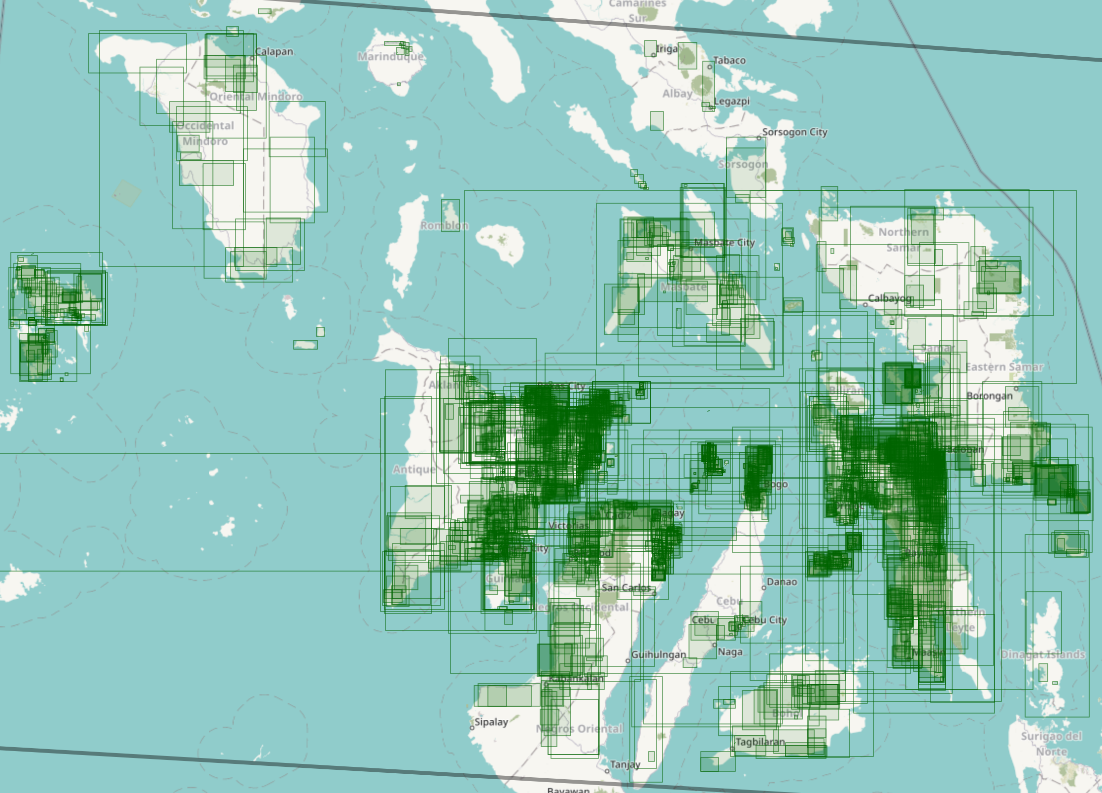
| Description | A visualization of the mapping activity from thousands of mappers all over the world before, during, and after Typhoon Haiyan hit the country. |
|---|---|
| Author | Visualization by Pascal Neis, base map tiles by the Humanitarian OpenStreetMap Team, base map data by OSM contributors |
| Source | http://resultmaps.neis-one.org/osm-typhoon-haiyan-2013/#8/11.453/123.050 |
| Date | Screenshot taken 2018-11-08 |
| Other versions | 
|
License
![]()
(apparently) not freely licensed (except the raw data):
- “copyright © Pascal Neis (neis-one.org)”
- base map tiles: Humanitarian OSM style
- map data © OpenStreetMap contributors
File history
Click on a date/time to view the file as it appeared at that time.
| Date/Time | Thumbnail | Dimensions | User | Comment | |
|---|---|---|---|---|---|
| current | 10:37, 8 November 2018 | | 2,236 × 1,608 (1.59 MB) | Seav (talk | contribs) | ==Information== {{Information | description = A visualization of the mapping activity from thousands of mappers all over the world before, during, and after Typhoon Haiyan hit the country. | author = Visualization by Pascal Neis, base map tiles... |
You cannot overwrite this file.
File usage
The following 3 pages use this file: