File:USA Airport Security Zones.png
Jump to navigation
Jump to search

No higher resolution available.
USA_Airport_Security_Zones.png (722 × 454 pixels, file size: 219 KB, MIME type: image/png)
Summary
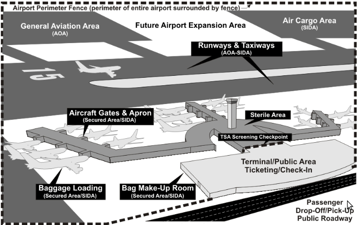
Diagram of airport security zones in the USA, from the USA Federal Aviation Administration.
Licensing

The copyright holder of this file allows anyone to use it for any purpose, provided that the copyright holder is properly attributed. Redistribution, derivative work, commercial use, and all other use is permitted.
If you are the uploader, please provide proper attribution including source and name of author.
If you are the uploader, please provide proper attribution including source and name of author.
File history
Click on a date/time to view the file as it appeared at that time.
| Date/Time | Thumbnail | Dimensions | User | Comment | |
|---|---|---|---|---|---|
| current | 16:28, 11 June 2015 | | 722 × 454 (219 KB) | Brycenesbitt (talk | contribs) | Diagram of airport security zones in the USA, from the USA Federal Aviation Administration. |
You cannot overwrite this file.
File usage
The following page uses this file: