File:Uprn vectors nw6.png
Original file (1,621 × 875 pixels, file size: 1.85 MB, MIME type: image/png)
Summary
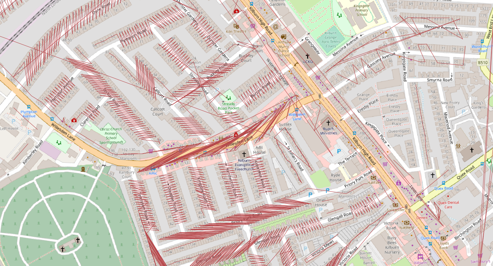
Vectors by name toid for postcode district NW6 (Kilburn, London). UPRNs are allocated to postcodes and then to streets (using the OSGB nametoid as unique identifier). Sequences of UPRNs with gaps of no more than 5 are then amalgamated to create lines of increasing (putative) housenumbers.
Contains (c) 2021 Ordnance Survey Open Data, UPRN data and ONS Open data (UPRN lookups) all available under the Open Government Licence.
Licensing
| Contains map data © OpenStreetMap contributors, made available under the terms of the Open Database License (ODbL).
The ODbL does not require any particular license for maps produced from ODbL data, produced maps may be subject also to other licences. |
File history
Click on a date/time to view the file as it appeared at that time.
| Date/Time | Thumbnail | Dimensions | User | Comment | |
|---|---|---|---|---|---|
| current | 14:32, 22 July 2021 | | 1,621 × 875 (1.85 MB) | SK53 (talk | contribs) | Vectors by name toid for postcode district NW6 (Kilburn, London). UPRNs are allocated to postcodes and then to streets (using the OSGB nametoid as unique identifier). Sequences of UPRNs with gaps of no more than 5 are then amalgamated to create lines of increasing (putative) housenumbers. Contains (c) 2021 Ordnance Survey Open Data, UPRN data and ONS Open data (UPRN lookups) all available under the Open Government Licence. |
You cannot overwrite this file.
File usage
There are no pages that use this file.