File:Using Indonesia water data for improving OpenStreetMap.pdf
Jump to navigation
Jump to search
 Size of this JPG preview of this PDF file: 463 × 599 pixels. Other resolutions: 185 × 240 pixels | 371 × 480 pixels | 593 × 768 pixels | 1,275 × 1,650 pixels. |
Original file (1,275 × 1,650 pixels, file size: 60 KB, MIME type: application/pdf, 4 pages)
Summary
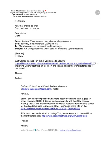
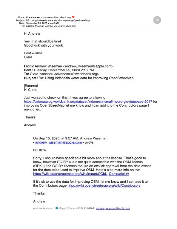
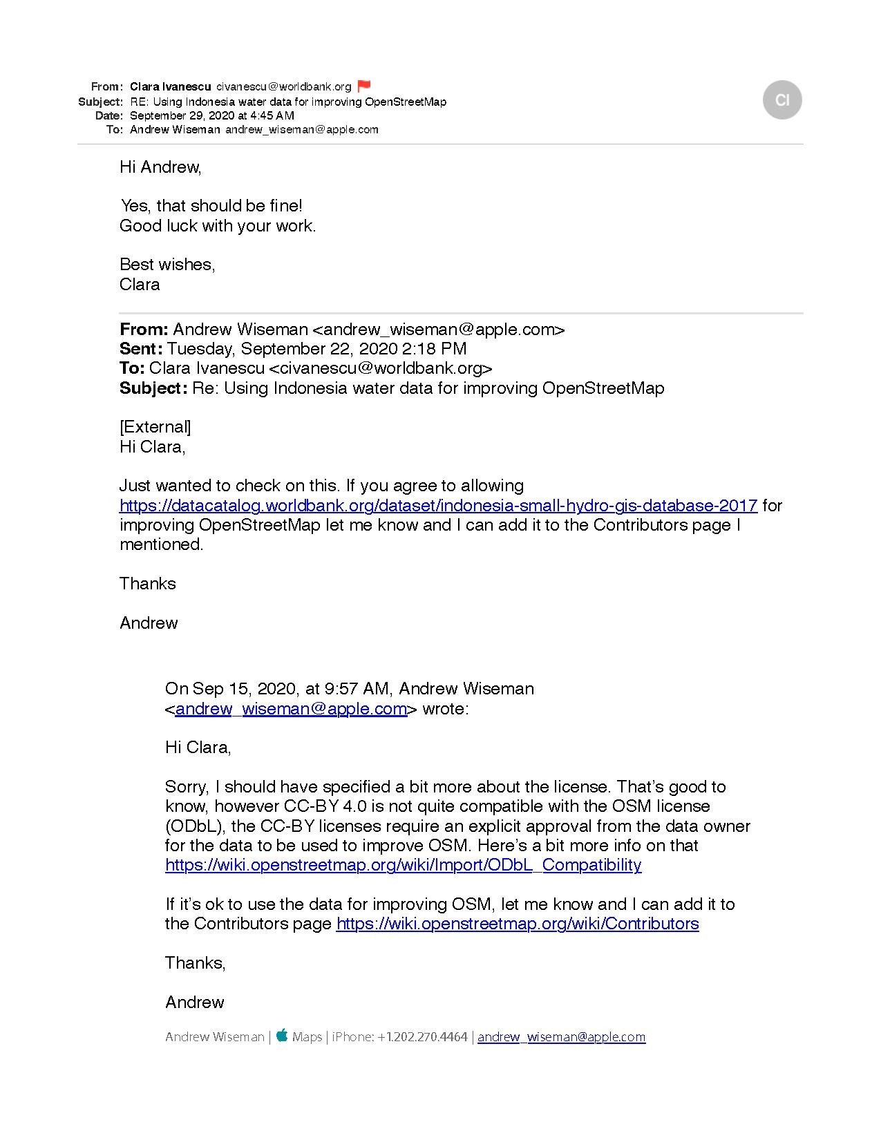
Approval for a World Bank dataset to be used for improving OSM
Licensing
- This media file was uploaded by author of the work and its copyright holder.
![]()
![]()
This work is licensed under the Creative Commons Attribution 4.0 License.
Attribution: Awiseman
Attribution: Awiseman
File history
Click on a date/time to view the file as it appeared at that time.
| Date/Time | Thumbnail | Dimensions | User | Comment | |
|---|---|---|---|---|---|
| current | 23:41, 5 October 2020 |  | 1,275 × 1,650, 4 pages (60 KB) | Awiseman (talk | contribs) | Approval for a World Bank dataset to be used for improving OSM |
You cannot overwrite this file.
File usage
There are no pages that use this file.