File:Utah-aerial-coverage.png
Jump to navigation
Jump to search

Size of this preview: 609 × 600 pixels. Other resolutions: 244 × 240 pixels | 487 × 480 pixels | 917 × 903 pixels.
Original file (917 × 903 pixels, file size: 156 KB, MIME type: image/png)
Summary
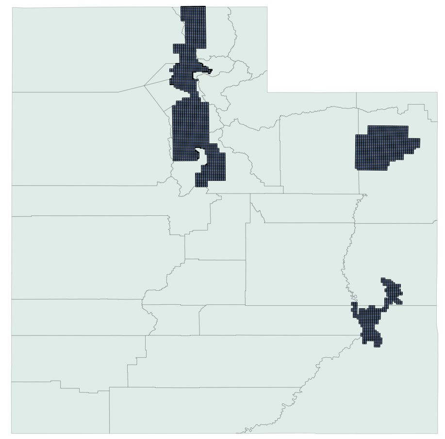
Coverage of state provided aerial imagery. Sources used: http://coastalmap.marine.usgs.gov/GISdata/basemaps/boundaries/state_bounds/state_bounds.htm and the index file on http://gis.utah.gov/aerial-photography/2009-hro-1-foot-color-orthophotography
Licensing
![]()
This file has been released into the public domain by the copyright holder, its copyright has expired, or it is ineligible for copyright. This applies worldwide.
Please, please use more specific template such as {{PD-self}} / {{PD-creator}} / {{PD-shape}} / {{PD-USGov}} / {{PD-old}} / {{PD-RU-exempt}} ... This template is not making clear why this work is in the public domain.
Please, please use more specific template such as {{PD-self}} / {{PD-creator}} / {{PD-shape}} / {{PD-USGov}} / {{PD-old}} / {{PD-RU-exempt}} ... This template is not making clear why this work is in the public domain.
File history
Click on a date/time to view the file as it appeared at that time.
| Date/Time | Thumbnail | Dimensions | User | Comment | |
|---|---|---|---|---|---|
| current | 16:36, 1 November 2011 | | 917 × 903 (156 KB) | Mvexel (talk | contribs) | |
| 16:26, 1 November 2011 | 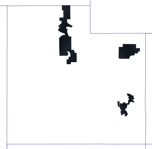 | 606 × 594 (58 KB) | Mvexel (talk | contribs) | Coverage of state provided aerial imagery. Sources used: http://coastalmap.marine.usgs.gov/GISdata/basemaps/boundaries/state_bounds/state_bounds.htm and the index file on http://gis.utah.gov/aerial-photography/2009-hro-1-foot-color-orthophotography |
You cannot overwrite this file.
File usage
There are no pages that use this file.